Monday, July 24, 2023

PCT Day 19: Bull Run to Cascade Locks

I got to admit, upon waking, I did not feel good. My sleep had been poor. I felt that I was awake part of the night and I was always aware of my location. I was uncomfortable and a little bit burned out. Still, I was up at first light and moving before 6 AM. Even moving was painful, though. My feet had been so abused from the day before that they were actually in pain. My last day and every step, especially with my right foot hurt. My Achilles tendon was so tight that it was now painful. I was hoping that it would loosen up, but every step seemed to hurt. It became so bad that I resorted to taking a couple of ibuprofen to make the pain go away after trying to work through it. The scenery was nice as undulating forest was the view for the morning. I passed Salvation Spring where other tents were parked for the night. Nothing any more remarkable than my spot.
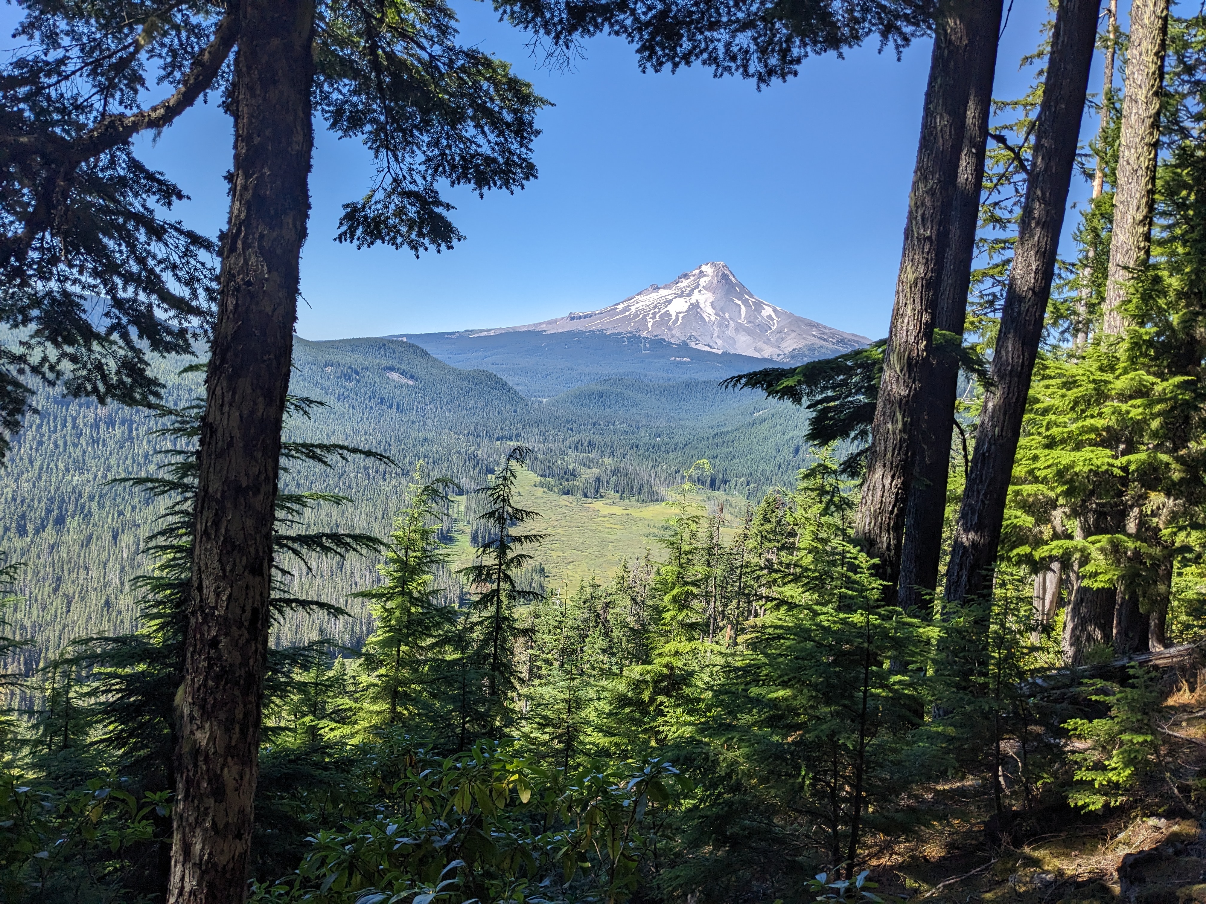
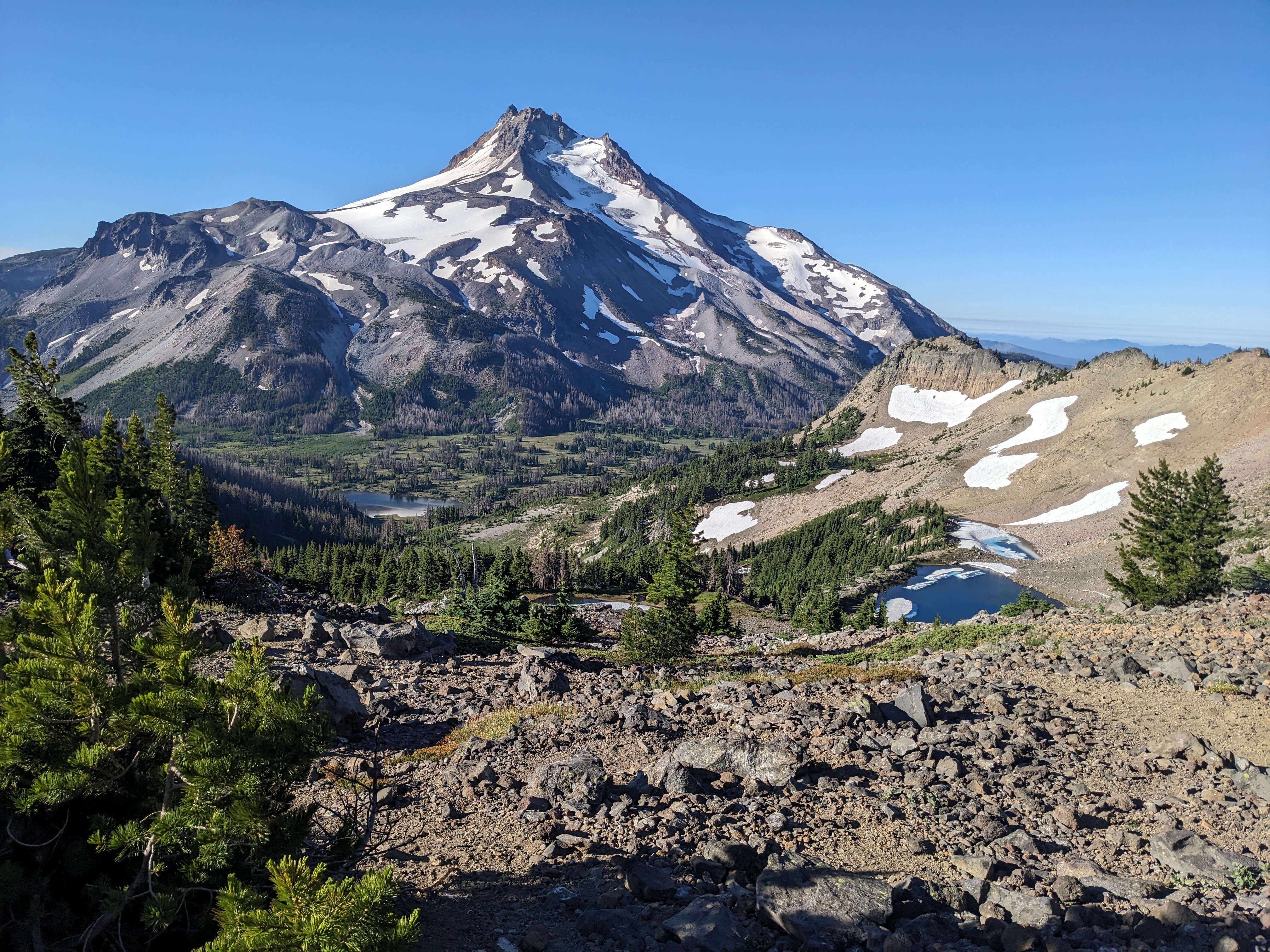
My impatience with the Oregon experience was hitting its breaking point. The forest was great, but there was not much to break up the view. Even a small lake along the way was so obscured by the amount of trees that it was not much of a sight to see. I wondered why this forest did not burn and really with how dry it currently was right now, I knew it was only a matter of time. My foot was slowly loosening up, but the pain was not completely leaving. I knew I could not be doing too much additional damage to it, but my body was telling me it needed a rest. Still I plodded on spending most of the morning in thick forest until I came to a more open view.
Here I could see the Eagle Creek drainage start to open up. I was high above it, but knew that this drainage was my passage to the Columbia River and my completion of the PCT through Oregon. I decided to take the Indian Springs trail. This would allow me to access the Eagle Creek drainage. I could go a little further to the northwest and drop down at Wahtum Lake, but this was the fastest route to my way out and I knew that this was going to be another 25 mile day. In all, I would have to finish 166 miles in 6 days. No wonder my feet were hurting. When I left the PCT to travel down the Indian Springs trail, it was sort of bitter sweet. As usual, there were some hipsters talking to each other, but here I was just going downhill.
The trail went downhill fast. I knew that the Eagle Creek drainage had been burned in a fire and this trail seemed to get the brunt of it. There were down logs to climb over everywhere and just a generally steep downhill grade. I seemed to be the only fool that was using this trail until I saw a very tired, sweaty guy come up the trail. He seemed tired, but he was friendly. He talked about the steepness of the trail. Each step was sort of painful, but it was now just about getting down. I did not lose the trail, but it was not one I would ever fondly look back upon. Finally I came upon the junction with the Eagle Creek trail and I was relieved to be done with that one. It suddenly became less steep and burned out. I promptly found a nice spot for lunch and took the pack off with an amazing view.
Now it was time for waterfalls. The trail seemed to be a bit busier at this point, but still, I was far enough away from the trailhead that it was quiet. I got to see Eagle Creek from the opposite perspective. Since it was right near the Interstate, most people hiked up, sometimes to the first waterfall, sometimes a little bit further. I got to see the waterfalls from the top down. I could see why there were so many waterfalls, because this drainage was steep. I was dropping elevation dramatically since taking the Indian Springs trail as I had to get down almost to sea level. I also was getting my first taste of raindrops on the entire PCT. I was welcoming them, though, as the overcast skies were such a nice break from the relentless heat that had been the norm on the trail thus far. It never rained enough for me to get soaking wet, though. I know all the forests of Oregon could use the rain because if there was a theme, it was that this place was dry. Waterfalls were starting to appear around every bend. I am not sure the grand total of waterfalls that I was to see, but it was definitely in the double digits. At first they were little and so were the crowds. 
The first truly dramatic one was a waterfall that seemed to twist around a bend in the rock. I never got a great picture of this one, partially because there were people all around, but also because I would have had to lean myself out on the edge of the trail. Trail construction here was quite amazing as there were paths cut out of the sheer walls. Some places you could tell it took some engineering to forge a path through the valley, but this was an important spot to Oregon's history. For over a hundred years, people have been trekking up and down this area to see these waterfalls. Sometime the path became very steep and exposed. It seemed like at least once a year there was a news story of a person dying in Eagle Creek. There was nowhere where I felt unsafe, but there were so many people making the journey up that I knew it was possible. Huge waterfalls began to appear and I was glad I went this way even though the traffic was much different than if I would have stayed on the PCT. If I would have been on the actual trail, all I would have been doing was counting down the miles until the journey was over. At least here, I was seeing some sights that I would remember for a long time.
As I neared the end of this trail, though, I was starting to get impatient. Boy did my foot hurt and there were so many people. It was relentlessly downhill which was not helping. I checked my watch endlessly as I avoided the piles of people. The stream was so pleasant and the people so excited to be there, but I was just thrilled when I finally spotted the parking lot. Here I used a bathroom with running water for the first time in I don't know how long. I then walked a road which took me to a campground. All day I had been hoping for cell service, but I was finally able to communicate with my wife. She was on her way to the trailhead, but she had spent a lot of the day in Portland and would be a little bit late. There was no reason for me to hurry.
Still I was just so happy to get the pack off my back that when I saw the sign for the Columbia River Gorge trail and it telling me that I only had 2.5 miles until I met up with Pacific Crest trail again, I was happy. This looked a little bit funny to have a guy with an overnight pack on what essentially was a bike trail, but I knew I had to finish in Cascade Locks. This is where I told everyone that I was going when starting the trail 19 days previously in Ashland. I had walked 420 miles and even though Jacqueline could pick me up at the Eagle Creek trailhead, I needed to finish this section. The paved bike path took me to a trail through the woods that hugged the Interstate. Here huge trucks and passenger cars went by at speeds of 60-70 miles per hour, while I slowly plodded my way on tired feet. 
It was almost anticlimactic when I popped out to a trailhead in the town of Cascade Locks. Here I met up with the PCT again and I took off my pack to use it as a seat. This lonely spot at the edge of town with a few cars parked and no people around was the crowning achievement of my hike. I felt relieved that the journey was over. A half an hour later my wife showed up and she brought the kids along. I was proud of myself with following through with my plans and that my kids could see that something challenging could be accomplished. I was so happy to go home though. The shoes that I was wearing were so trashed by this point and my feet were in so much pain. It would turn out that the following day, my Achilles on both ankles would be so sore that I could barely walk around the house.
420 plus miles and the last day had nearly done me in. I was so happy to see my kids and family. I was very tired, though, and even though I was usually the one to drive, I let my wife do the driving. I was hairy, dirty, grimy, sore, but refreshed. Something like the PCT is only exciting because it is so different. Most of life is waking up in the morning and attacking the to do list. Even more of the time, that to do list is filled with activities that you do not want to do such as a job. This job can not become my life. My life needs a balance. One thing that I discovered on the PCT is that I really did not spend a lot of time soul searching. I realized that I had it pretty good. I had a house by the river, two wonderful kids, an amazing supportive wife, great friends and family, an enjoyable career, and a happy existence. I lived in probably one of the most beautiful places in Oregon and I was happy. A journey such as this allowed me to keep the balance. I was now rather satiated on the adventure part of my life and was ready to settle in for the long haul that would be the school year. Still it would not take me too long to start thinking what it would be like to hike the PCT through the state of Washington?

Sunday, July 23, 2023

PCT Day 18: Barlow Pass to Bull Run

I had to wake up early if I was to make it in time for breakfast at the lodge. At 9 AM, there was a breakfast buffet at the Timberline Lodge and I pushed myself all week to try to make it. I had made friends with a French couple and they invited me. I know they probably did not care if I made it or not, but it gave me a goal to shoot for. That meant that I was up at 5:40 AM and on the trail by 6:20 AM. I was surprised by the fact that once again I was one of the last to leave by that time in the morning. I was only 5.2 miles from the Timberline Lodge, but it required consistent uphill hiking to get there. This was actually one of the steepest places on the whole trail so far and my feet were sore. The Achilles issue I had been struggling with was turning into a bigger problem. It hurt for at least an hour every morning and no amount of getting it loose was going to make it go away.
So I dealt with the pain and the sweat. I was surprised how warm it was even early in the morning. No wonder the glaciers were melting away. The trail was sandy in many places also and the easy 5.2 miles became a push just to make it to breakfast on time. I will be honest, going off trail to head down to the Lodge was harder than I thought it would be. Given my exhaustion level, anything extra felt unnecessary. Still, this was my goal and I was going to achieve it. The lodge was under construction, so I luckily found the right building. Breakfast was upstairs. When I arrived there, it was packed. Many times you hike the trail and wonder where the other PCT hikers are. I found them all here at breakfast. Since I had been moving so fast, the only people that I really knew though were the French couple. I was lucky that I knew them, too, because all the tables were taken. The server allowed me to go sit next to them and it helped him a ton as there were many people waiting for breakfast. There was so much food, I felt like gorging myself, but I refrained. A couple of plates were all I could stomach anyway and it was great to have some good conversation. This was probably the only time on the trail that I had told anyone anything personal about my life. Often times you hear about the lifelong friendships made on the PCT. I did not feel the same way. The people were in and out of my life so quick that there was not any time to build any lasting friendships. Even the French couple, I did not even know their names.
I paid my bill which unsurprisingly was probably the most expensive breakfast that I had ever purchased for myself. The French couple was going to spend most of the day just hanging out around the lodge. I, on the other hand, was trying to get enough miles in to finish the following day. They were a little bit jealous of me as they still had another 500 miles to go hiking through Washington. I wished them good luck and was on my way. It was Sunday, so the trail was busy. This was a popular spot for hiking for people from Portland, so I encountered many day hikers near the lodge. There were even some people riding the ski lift up to either ski or just hike around the high points of the mountain.
Mt. Hood was definitely impressive, but I honestly though it would be more snowy. There was a ridiculous amount of water and glacial till around, but not much snow. Because I was on the flanks of the mountain, it meant that the trail was nowhere near flat. Instead, it went up and down as I skirted the southern than western flanks of the mountain. It generally headed in a downward direction, but this was hard to realize when I was steeply climbing up and out of a glacial valley. As I got farther from the Timberline Lodge, the number of people began to dwindle, but it was still one of the busiest section of the trail. The views were incredible, but eventually they changed from open mountain slopes to forest after crossing the Zigzag River. The vegetation was pretty lush at this point and the trail was now switchbacking downhill pretty much relentlessly. Down and down I went and I saw the tired, sweaty faces of the people going uphill. I was glad that I was not going to have to go back up this hill that eventually led to the Sandy River. This was an issue as this river was quite full of water and there was no bridge for me to use to cross this river. Some people brought Chacos or Tevas for this exact purpose. Others went barefoot. Given my current foot issues, I could not risk it.
So I just found a good place to cross and did it with my shoes on. The crossing was not actually that rough even though there were a couple of people wandering around trying to find an easy way. After fording the section of river at Mt. Jefferson, the Sandy River was much easier. The problem was that I now had wet feet and I was going to have to deal with that the rest of the day. I spent some time eating lunch and letting my shoes dry. I tried using dirty and clean socks to soak up some moisture, but there was nothing I could do but just suck it up and hike with wet feet. This could be a problem, but for now, I was just going to put in the miles. Right after the Sandy River, the trail changed. It was hot and I was feeling the heat, but the trail took me to a junction. 
I had the choice of staying on the PCT or taking a side trail to Ramona Falls. I was not going to avoid this opportunity and took the side trail. This was a popular spot to day hike too, so the clientele changed quite dramatically. There were all sorts of people on this trail and when I got to the waterfall, there was barely a place to sit without encountering another human. I filtered some water from the creek and then was off on my way. I choose to not go back to the PCT, but instead just take the trail down the creek. This proved to be a good choice as it was shady and very pleasant. When I got back to the trail, I encountered another PCT hiker who I chatted with. He criticized my choice roundaboutly. He said he was a red liner meaning that he allowed himself to go to other places on the trail, as long as he returned to the exact spot he left the trail. The rest of us were blue liners.
Having breakfast with the French couple, I was inspired by their perspective on the trail. They had skipped a couple of parts including a big section of the Sierras. They would not be heading back. They decided early on that their experience was hiking from Mexico to Canada and whatever section of trail that they missed was just going to be missed. I liked that perspective and the red liner perspective was much too serious for me. I had decided that my perspective on getting off trail was that I would only do it to see something exciting. I had been debating about whether to hike Eagle Creek the following day or stay on the PCT proper. This sort of confirmed for me that Eagle Creek it would be.
From here, the trail climbed again. This was thick forest and I had a new group of friends. Biting flies seemed to be all around. They hurt more than mosquitoes but bothered me less because I did not have to deal with all of the constant buzzing. I was moving pretty good at this point with my feet feeling alright. It never seemed to bother me too much to go uphill or downhill, just had to keep myself moving. When I reached the top of the hill and left the Timberline Trail, all of a sudden, the biting flies stopped. This made me happy, but mostly, now I was starting to get excited to be done. More forest lay ahead of me and it led me downhill to Lolo Pass. This was a place with a road and a campsite. It was unoccupied and it would have been so easy to stay there as it was in the evening and time to camp.
I had to continue on, though, as there was a place on the map called Salvation Spring which could be a good place to camp. I went uphill again until I ran into a spring. There was a couple filtering water there and we talked for a bit. They were continuing on also, but would camp in an hour or so. I was tired and I decided that when I found a good place to camp, that I would just do it. Now I had water and I was within close enough distance to make it to Cascade Locks the following day. So after another hour or so of walking, I found a flat place by the side of a dark spooky section of trail and set up camp. I was filthy and tired, but I need to camp. After dinner and a little reading, it was time to quickly try to sleep. It would be my last night out on the trail.  


Saturday, July 22, 2023

PCT Day 17: Warm Springs River to Barlow Pass

I definitely did not sleep enough. Getting in late, being grimy and sweaty, it was a rough night. I even got a late start, not hitting the trail until 7 AM. Still I was not ready to get moving and putting on the pack again for another long day was going to be rough. My feet were so sore, especially around my Achilles. I had to move very slowly and I could not overextend myself at all. It was actually rather painful and it took quite some time to loosen up. The trail climbed slowly uphill, but it was barely noticeable. Then it descended slowly downhill. The trail was quiet, but I did run into some people on horseback who were far too boisterous for my current mood. I was about the miles today and I would not be happy unless I could cover a fair amount. Having done 31 miles the previous day, it would be tough to pack away even more miles today.
After about 7 miles, I was in Mt. Hood National Forest. This would be my first time hiking around Mt. Hood and I was preparing myself for the onslaught of human beings that was likely to be there. The trail was quiet at first until I came to a road with cars driving much too fast and probably the largest, fanciest sign I had seen thus far for the Pacific Crest Trail. From here the trail went right next to Timothy Lake. It was a beautiful lake and the trail was flat. There were numerous campsites by the lake mostly all occupied given that it was Saturday during the summer time. I thought about swimming in the lake, but knew if I took any extended break, I was likely to not make it to Timberline Lodge the following day for the buffet breakfast. So I plodded along always thinking I would have another opportunity to stop at the lake and get some water if I needed to. The lake seemed to last forever, but soon I was at the last little arm of the lake. I found a quiet spot to have a little lunch, but I neglected to refill my water. This would come back to haunt me later. Passing the junction for Little Crater Lake, I passed my last chance to fill my water.
The trail climbed steeply from here. The trail was all of sudden not shady and pleasant anymore, but rather hot and dry. I moved slowly uphill. My feet loosened up but I still was not moving quickly. I passed a group of younger PCT hikers resting in the shade. Given the miles I had been putting in every day, I was leaving behind many familiar faces. These new groups that I was running into were full of people I hadn't ever met. The trail climbed toward Wapinitia Pass. The heat and the uphill hiking were making my water supply deplete rapidly. I was hoping that at the pass, there may be running water. As I climbed, eventually the views of Mt. Hood were beginning. It still felt so far away though.
When I got to the pass, there was nothing there as far as running water. The pass itself was just a place to cross the road, but there was a big parking area right by the turn to Frog Lake. Here people could park and get on the PCT. I was happy to sit down on a bench with a picnic table and throw away the garbage that was in my pack. It wasn't like it made my pack that much lighter, but it did make it more cleanly. I didn't rest too long before I was climbing uphill again. Now, though, I was getting far too low on water. When I looked at the map, I could see that I would not cross any more creeks. I had an important decision to make. There was a junction just above me where a trail less than a mile long descended down to a lake. I had no choice but to leave my big pack and take the water filter and my water bottles down to the lake.
It is hard to describe how frustrating it is to get off trail because of poor planning. These were miles that I would have to add on and time that I would not get back. I even shortcut the trail because I needed to get there in the shortest amount of time. The lake itself looked so nice. How much fun would it be to just camp here for the night? It was shady and the lake was nice and warm. There were plenty of people swimming and camping around the lake. Instead, though, I would quickly fill the water bottles. I had to go out on a log and precariously balance to get the water, but eventually I had drank my fill and filled up the bottles. Then it was back up the trail I had just come down. I had lost a half hour which may not seem like much, but I wondered if I was going to have enough energy to make it close enough to Timberline Lodge. My goal for the night was Barlow Pass. From the lakes, it was only two miles, but it was uphill and it was getting late in the evening. I persevered and I soon found myself at a nice large sign letting me know it was Barlow Pass. I was very happy to be there. When I looked around, though, there didn't seem to be many campsites. A couple of people pointed out to me that there were more places to camp down the road, so I found a nearly flat spot down the road. I set up the tent, made a quick dinner, read my book, but mostly I was just happy to not be moving for a while. I had put in 27 miles to make it to this point, but I knew I had another full day ahead of me the following day. I would have to be up early if I hoped to make breakfast at Timberline Lodge.


Friday, July 21, 2023

PCT Day 16: Jefferson Park to Warm Springs River


I wish I could say that I got an early start on this day, but hitting the trail at 6:45 AM does not count for that on the PCT. I am sure that a good majority of people were will on their way far before I was moving on mine. I had enjoyed a restful night's sleep after being clean. It was a little cooler up at Jefferson Park also, so the night was more enjoyable. Luckily, also, there was a bit of a breeze through the night, so that my shoes were able to dry out after crossing the river the previous day. I had left them open and exposed for the breeze to do its magic and it had worked. So far, my feet were feeling good and when I woke up I was feeling great. Jefferson Park was amazing and I really enjoyed being there. It was tough to leave as I knew today would be a lot of pounding the trail to get the miles in. 

The trail climbed uphill pretty quick. I realized right away that most of the cool people camped up high because of the amazing views. I took a bunch of pictures, because you had great views of Jefferson Park up here. The trail was not too steep and I was making good time even with stopping often for the photo opportunities. There were a few late starters that I passed as I went up the hill and quite a few people camped at the high point. This was like the dividing line. When I turned my back on Jefferson Park, I was heading out and pointing my head forward toward Mt. Hood. I wanted to continue living the Mt. Jefferson experience as long as possible as it was an amazing mountain. 
From here, it was time to point the legs downhill. I passed some snow, some small lakes, some beautiful meadows with flowers like lupine and paintbrush to enjoy. There were uphill hikers with the excitement of getting to Jefferson Park permeating through their being. I talked to quite a few people and they seemed to be in great moods and really commenting on how beautiful the area was. I agreed and I felt so invigorated by this place. I could see the best of it was soon to be over, though, as the charred forest became ever so much closer with each step. Eventually, I was there and I would not leave it for a long time. I was moving pretty good, though, on this day, so I tried to keep it going as much as possible.
It felt very hot and dry. I liked to call these areas ghost forests because the trees stood like skeletons, shadows of their former selves. Even a rest beside what should have been a spectacular mountain lake felt almost empty with the scenery around it so damaged. There were a lot of people out and about, so I chatted with quite a few people on the trail, but I realized soon, that this day was going to be about making the miles. I wanted to get out of the burnt forest as soon as possible and since most of the trail was downhill, I was moving pretty good. Eventually, I made it to the Olallie Lake Resort. This was the borderline between Mt. Jefferson and the Warm Springs Indian Reservation. 
I did not spend an incredibly long amount of time at the Olallie Lake Resort, even though some pushy ladies said I had to go to the store. It was so wonderful. I am not sure why I rejected most of the civilized places to stop on the PCT. I think I just wanted to have the experience of being out there and not relying on any comforts of home. I also knew that a stop at the store would delay the excellent progress I was making that day. So instead of going to the store, I crossed the road and found the shadiest spot I could to have my own meager lunch. Thankfully, the burned forest was giving way to tree cover. The terrain changed also being fairly flat with a slight downhill grade. That was one thing about today was that there was not too much altitude to endure.
The rest of the day became about getting in the miles. The forest was nice, but it became rather repetitive. It was hot and dry, a good place for a fire to break out. I was feeling good and moving, but there were not many places to break up the monotony. The first goal was to get to Jude Lake and then after that I was able to make it to Lemiti Meadow. Here, I had to take a slight detour out to the campsite to get water from the spring. The swampy marsh did not seem like an appealing spot, but with the water filter, the water was still potable. From here on out, though, it was a test of will. I knew that if I put in a big day today, I had a chance of getting out in just three more days. So far, until this point, I had been really good about being patient with the experience and just living in the moment. Now, though, I was starting to just realize how close I was to finishing. If I made it to the Warm Springs River Footbridge, I could make it to the Timberline Lodge for breakfast. I saw the French couple again and they seemed to be doing the same thing on this day. 
I was not moving incredibly fast at this point. It was evening and here I was still putting the miles in on the trail. There were not a whole lot of landmarks to keep me motivated either as the South and North Pinheads were nothing too unique. It was slightly concerning also, because every campsite seemed to be taken. I was running into so many hikers in this section which seemed bizarre given the remoteness of this place. After passing the Pinhead Saddle area, it was all downhill from there to the river. It was easy going, but my feet began to get tired. This was probably too big of a day, one that I would likely pay for later. By the time I finally pulled into camp, it was 8 PM and finding a spot was nearly impossible. There were deadfall all around camp and luckily I was able to find a flat piece of ground to put down a tent. I took care of camp chores which on this evening included filtering water from the same place I would dip my toes in. I was not able to fully submerge and get myself completely clean, but a soaking of the legs was definitely in the cards. A quick dinner and a few minutes of reading still got me in bed at a late hour. I wondered how much I was going to pay for this day later, but for now I could revel in my 31 mile day. This was my longest day on the PCT and I would have never thought I could put in these miles when I started. 


Thursday, July 20, 2023

PCT Day 15: Wasco Lake to Jefferson Park


Waking up was a little tough, but also a little too easy. After putting in such a full day, it can be hard to rest. I was rather wakeful during the night and when you know what is in store for yourself during the day, sometime it can be hard to come down and relax after putting in so many long miles. I was up before 6:00 AM and on the trail by 6:20. This was fairly average I would say and there were plenty that had found the trail before me but some who had slept in longer. Still, I was up the hill and back on the PCT in no time.


I found a trail with so many blowdowns it was actually rather exhausting. Having been on this section of trail in June, I thought when I saw the trail crew here, that they would have this nice and cleared out by the time I found my way here. Instead, it was blowdown central. The blowdowns were a place that I held an advantage over many people because I was taller. I ran into the French couple that I had seen many times so far and this was the one time that I was able to out hike them because of the blowdowns. In fact, at one point, I seemed to find my way to a different trail after having to use the GPS on my watch to navigate. The trail must have been rerouted in this section, but it did not seem to matter as there were blowdowns everywhere.


Eventually I made it past the blowdowns only to experience new challenges. I stopped near Rockpile Lake to get some water. By this point, I could discern a good campsite when I saw one on the PCT and Rockpile Lake probably saw its fair share of campers each night. The north side of the lake was forested and shady, while the lake provided water and a place to clean off. The mosquitoes were not great, but they were not horrible either. There were quite a few people stopped here and talking. Sometimes I felt a little left out because so many people seemed to know each other well. I was always friendly and pleasant, but never made any long lasting friendships. The trail continued, this time through some thick woods onto an exposed ridge. I was past the fire scar, which was great, but now I got to look at Mt. Jefferson looming so far off. The trail was quite exposed in this section near and past South Cinder Peak until North Cinder Peak. The views were spectacular and Mt. Jefferson was showing why it was one of Oregon's most beautiful places. 


The trail hit a pass just past North Cinder Peak at the junction with the Hunt's Cove Trail. This was an area that I visited previously having backpacked out to Pamelia Lake last year. I day hiked here and ran into quite a bit of snow in late June. This time the snow was gone and the trail slowly descended to Shale Lake. Here I ran into most of the other people that I had been seeing all day. They were having lunch by the lake. I found a nice shady, quiet tree to sit under and had myself a mid day meal. I finished it off filling some water down by the very shallow lake.


Having been here before, I got a little careless and thought I knew the right way to go. Turned out there were a lot of camper trails around here that went off in directions that were away from the PCT. I thought I was following one trail and then it ended. I thought I knew the way the trail would eventually come out, so I headed cross country over difficult terrain. This turned out to be the wrong choice and eventually I had to stop, reorientate myself, and throw the towel in. I headed back down the steep, rough terrain I had just fought to climb up. Getting lost is frustrating, but I only added maybe a mile to my day and an extra 20-30 minutes of hiking. I didn't let it bother me and soon I was back on the trail.


This section of trail was right above the shores of Pamelia Lake. It was so hot and dry. The trail really felt like a tinder box that could go up at any time. There had been no rain for quite some time and this was one of the few long stretches of unburned forest I would see in Mt. Jefferson. This really is a pretty area around Pamelia Lake, but I felt like it was overwhelmingly warm while I was there. This seemed like a place where people could just fly through the section of trail and I saw many people that were at lunch pass me including the French couple. They were quickly becoming my closest friends on the trail, which honestly was not that close. 


I was soon to pass the junction down to Pamelia Lake and the trail began to climb back up to Woodpecker Ridge. Having been to this place the previous year, I knew the trail was still closed here last June, so I expected some rough, exposed terrain. I got what I expected as this area was so amazingly scarred from fires. These fires were around the same time as the fire that we experienced in 2020. I believe this one was the Lionshead fire. Regardless, it was torched and it made for some very warm, desolate terrain. Luckily, there were some streams around, so water was not an issue, but it still had a very eerie feeling. I knew I did not want to camp around this stuff for the night. That meant that my only choice was to push on through to Jefferson Park. There was a water crossing right before the burn that had been a place on the map that could have been a problem for fording the stream. It turned out to be a piece of cake, but up ahead I knew there was another. It became more apparent when I saw someone heading south and he asked about the water crossing I had passed. I figured that meant that his water crossing had not been so easy. I also saw a very strange site near this when I passed a group of 3 girls with balloons on very heavy backpacks. I had been so exposed to PCT hikers with their minimalist gear that I knew they must have been hiking for a short distance to have extras such as this. 


Eventually I made it to the fordable river. It did not look fordable and instead looked rather formidable. Luckily, one of the French couple was sitting right across the river proving that she had made it across. She pointed me to the place that she had crossed and even handed me her trekking pole to help with the crossing. It all went rather smooth enough as the water flowed over steep waterfalls below me. I was happy to have that crossing done and over with, but now I was walking with wet shoes and it was starting to get closer to camping time. I knew I had to make it to Jefferson Park for the night.


I was moving rather slowly by this point, but going up the hill, I found myself finally starting to emerge from the burn area to a spectacular meadow filled breathtaking park. The term park gets thrown around rather haphazardly, but this felt like it. Huge and open and dotted by large fresh water lakes, this place felt like it could fit many a weary traveler and still have room for everyone to enjoy it. I loved the small creeks flowing next to the trail and even though the fires had impacted this area, it still was living inside of a piece of artwork. 


I made my way to the largest lake in Jefferson Park which was Russell Lake. I camped along the southern shore of the lake in a bare patch of ground with a little bit of tree cover and a few mosquitoes to keep me company. The views of the mountain from my tent site were fantastic. After getting up the energy to take a cooling dip in the lake, I made some dinner and put my shoes out to start the drying process. I was lucky because there was a nice breeze. I took the soles out and aimed my open shoes with the wind blowing right in. With any luck, they would be dry by morning.


I had only put in 23 miles today, so I had a little more daylight than normal. I needed that extra hour tonight as 50 miles in two days seemed like plenty. I was able to get my phone and watch charged back up and even got a good chapter into my book. With the cleanliness of the dip in the lake to revive me, I was able to get a full night's sleep. Something about being in Jefferson Park really made me relax and just enjoy myself for the night. It may have been my favorite place and favorite campsite on the whole trip.

Wednesday, July 19, 2023

PCT Day 14: McKenzie Pass to Wasco Lake


I debated for a long time whether to hike from McKenzie Pass or just start at Santiam Pass from Big Lake. I had hiked the McKenzie Pass section previously, so I could easily skip it. Frankly, though, I had enjoyed hiking in places that I was familiar with, so I decided to still go for it. I was able to get Jacqueline up early and she gave me a ride to the trailhead. It was sad to leave my family again, but this time it would be the last. I only had 166 miles to go, which still sounds like a lot, but considering I had already hiked 254, this was going to be easy. I had the incentive of being able to get off the trail after this. 
By this point, I was getting tired, but I was going to finish my goal. I had done a great job of not getting impatient, so far, and I think that was my saving grace. This last leg, though, I wanted to see what my body could handle. I was going to try to pull it off in 6 days which would mean an average of 27 miles plus per day. This would mean getting up with the sunrise and going to bed with the sunset. 

I was well on my way at 8am. The trail climbed through the lava fields beneath Belknap Crater. I could imagine that this would be really annoying without fresh legs. Having taken a day off, though, I was feeling pretty good. The lava rock was everywhere and it was all uphill. Then I topped out on a trail I had been on a couple of times. The spur to the top of Belknap would have to wait for another day as now I went down the other side of the lava flow. This put me into forest some of which was burned out from previous fires. I went past the place where I would turn to go to George Lake, one of the best lakes I have ever been to, and continued along the slopes of Mt. Washington.

The trail was rather quiet as I climbed the hill. The pack was a little bit heavy with 6 days worth of food stuffs in there, but I felt like so far, I had done a great job packing. Eventually Big Lake came into view. It was such a far retreat from where I was with its jet boats and people yelling near the water. I skirted it for quite some time before popping out on the trailhead. From here, I took the connector trail that went between Big Lake and Santiam Pass. This trail, I had never hiked before, but I spent quite a bit of time cross country skiing it in the winter. There was an obscene amount of blowdowns on the trail and then there was a trail crew. I was happy to see them and thanked them for their work. It is always the right thing to say to a group of people sacrificing their time to make your hike better. 

I eventually made it to Santiam Pass and it was hot. The trail led uphill from here and given that it was in an old fire scar, I did not have much reprieve. The day had been so quiet, but I was now starting to see a few people again. I knew they were PCT hikers because I would see them resting and then they would blow by me a few minutes later. When talking to people later, I learned that many people just skipped the section that I just did. They would get a ride down the hill from McKenzie Pass, but they could not get back up to it. They would take a ride to Santiam Pass and skip the 16.5 miles it had just taken me to hike all morning and early afternoon. 

The trail continued to climb and eventually I found myself back in the forest. I was feeling pretty tired having already put in 20 plus miles by the time I got back into the woods and the water supply was running low. Eventually I found a nice little pond in the woods to filter water from. This made me feel a little bit more secure as I continued to traverse the narrow trail along the high cliffs of Three Fingered Jack. Eventually the trail popped out to the slopes of Three Fingered Jack and I got some of the best views of the day. Having hiked past Mt. Washington and Three Fingered Jack in one day was quite the feat, but it was made even better by the views of the upper slopes. In fact when I came around a corner, I could see down into Canyon Creek Meadows, a place the family and I went just recently, and had to text a picture of it to the wife.

At this point I was tired, but I was so close to Wasco Lake that I had to make it there. I knew I could take a dip in the lake and having a clean body was so important in the evening. Still I was wondering if I would make it there before dark and after talking to many other PCT hikers, it seemed like that was the goal of everyone I was running into. The blowdowns did not help the tired legs and body, but eventually I made it to the turn off. When I got to the lake, it was like a party. There were so many tents. There was no way I was going to invade someone else's scene, so I found a spot down a lonely trail at the far end of the lake. There was a clearing just big enough for a single tent and I made myself a home. The only visitor I had that night was a single deer most likely upset over me invading his space.

I did find the time to take a dip in the lake, even though it was nearly dark. The cool waters refreshed me, but it was more about necessity than enjoyment. Then it was a rehydrated dinner, just enough time to read a chapter of my book, then it was off to sleep. Probably put in a little over 27 miles, so well on my way to meeting my goal.