What makes someone stop just an hour from home to hike a trail that 99.99999% of the population does not know exists? The answer to that ques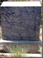 tion has to be something similar to George Mallory’s, “Because it’s there.” Truly, I have been seeing the Ketchump Trail show up on maps I have owned for 2 years living in Norwood. Knowing that this could very well be my last hiking trip near Norwood, I pulled over and parked just across the Dolores River in the town of Bedrock. I was not sure where the trail was as it was not hiked often, but after wandering through a century old cemetary into a wash, I located it above the wash. It was in pretty good shape. I knew from the road that it was going to go up quick, but I was not prepared for how well defined it would be. It was in good shape, very easy to follow. Along the way the view of
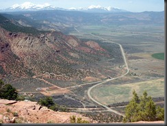 nued for many miles though, so there was no use trying to get somewhere else. I had only been hiking for forty-five minutes, but I turned around to enjoy the wonderful view for one more trip down. West-central Colorado had been a beautiful place to live in. I was happy for the experience and will have a warm place in my heart for the people and places I had a chance to interact with in Norwood in the 2 years we spent there.
Sunday, May 8, 2011
Ketchump Trail
Saturday, May 7, 2011
Goblin Valley
Jacquelin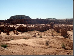 e and Zyla met me for the Mother’s Day weekend in Green River. They took the brunt of it having a 4.5 hour drive while I got a measly three hours. We stayed at the Comfort Inn Friday and Saturday night and were able to celebrate Mother’s Day as a family on Sunday. I figured this would be a good opportunity to go to a place that I had driven past many times on my way to Hite to visit my dad when he lived there, but I never actually took the turn. Goblin Valley which from Green Ri
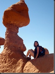 ver was only about an hour’s trip. The weather was nearly perfect out when we arrived. It was a little hotter out than we had been experiencing, but we needed to warm up a little bit. The parking lot was nearly full at the viewpoint. We looked down and saw many people scrambling around on the rocks. This looked like a ten year olds dream when it came to Parks. Goblin Valley is a state park and people take sure advantage of the laid back policy about scrambling around on the rocks. There is virtually no vegetation to destroy as hundreds of hoodoos stick up to be scram
Sunday, May 1, 2011
South Mountain
I had been wanting to get into the La Sals for quite some time. Now that the move from Norwood was only weeks away, I would probably never be this close again. I had a good chance for unseasonably cold weather on the weekend which could make for good spring conditions as the snow might actually stay hard for a while. I did not get up very early, only rising at 7am and out the door by 7:30am. An hour and a half later, I was driving on a dirt road and eventually stopping where the ice started to appear all over the road. I knew that this would be mud when I came back as it was 30 degrees when I left the car, quite chilly for a May day. A few surprising details had entered into my thoughts on climbing 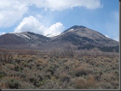 South Mountain, the one peak all off on its lonesome in the La Sals. First, there was a trailhead that I could not reach and was most likely covered in spring snow. Second, there was a trailhead right next to where I had parked. This was on my map, but it looked like it went in a direction I did not want to go as it head toward the north side of the peak which was more than likely covered in snow. I made my way toward the southern side which I knew lay mostly free of snow. I tried to keep myself from going uphill as I knew there to be a false summit on the ridge I was leaving from. Still the draw to push uphill was there and eventually my body dragged my mind into believing I would be alright going uphill. At first I chose the best route to avoid the scrub oak. Eventually, I chose the best route that would allow me to move through the scrub oak. It was so thick that I knew I was wasting a lot of energy fighting it while also going uphill. It became exhausting, so much so that when I finally found some boulders it was a welcome relief.
 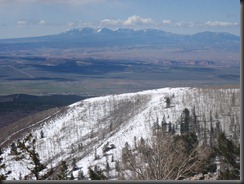 The views finally opened up after a bit and I could see the Abajos off to the southwest. The terrain began to open up also as the scrub oak gave way to aspens. I was starting to catch up with the snow also. First it was hard and I did not need my showshoes, but after a while I gave up and put them on. I was carrying them
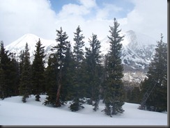 r, then aim for the next tree 25 feet up. Finally, I hit the ridge again. From there it was an easy walk up to South Mountain’s other summit of 600 feet lower. When I got here, I was spent. Hungry and exhausted from four hours of going uphill in cold weather with difficult terrain. I looked over to the actual summit and knew that I did not have it in me to go down
 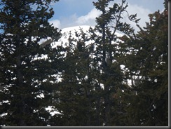 300 feet and climb nearly 1000 feet back up. To add to my tiredness, the weather was not looking particularly good as storm clouds were to the south and north from the peak. It felt good to go downhill and the slope seemed even more gradual than before. I was definitely sticking to the ridge on the downhill and I would also be aiming to the north to get into more snow to avoid as much scrub oak as possible.
 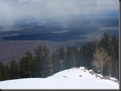 I took out the camera to get a picture of the beautiful ridge I had to go down. Just after I put it away, in a group of rocks, a big head peaked out at me. Hello Mr. Bear! or misses, not quite sure, but it definitely was a bear. I had been seeing tracks all day and now I had seen the beast itself. It was confirmed by the shear number of tracks around this area and I assumed as it did not run away in
 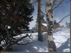 any direction, that this was its den. I did not get close enough to investigate, but as I was whooping and hollering, I snapped a photo a good distance below its lair. Then I continued downhill, turning off my music now for a little while and looking over my shoulder for a short distance until I was far enough away. This was the first bear that I ever saw in Utah. From here
 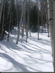 the ridge got steeper and steeper until I was switchbacking between trees to make sure I did not go slip sliding away. Sharad was doing his duty here as an ice axe gave me a little bit of extra support. I knew I was varying from my original route quite a bit, but with the snowshoes on, this route down seemed like the more economical approach to the car. That was just the one worry was whether I would be able to actually find the car parking randomly on the road. Just when the route stopped being steep and the snow showed its first sign of letting up, I looked up to see what appeared to be a trail.
 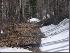 I took off the snowshoes for the first time in a few hours and began to follow this trail. I was hoping and soon realized, that yes this probably was the trail that I had parked near on the way up. I made a few wise choices at junctions and eventually popped out at the Xterra. I was extremely pleased to both avoid the scrub oak and not have to wander around looking for the car. I felt very content as I drove away. My body was tired and I ha
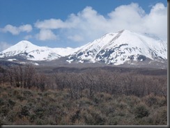 d a great day in the mountains. The fact I did not summit bothered me a little, but all and all I was extremely happy with my choice of adventures on this day. Looking back to see Peale and Tuk, I knew I would be back, hopefully sooner rather than later to stand on top of their awesome peak tops.