Wednesday, October 26, 2011

Durable Surfaces

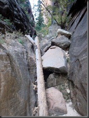
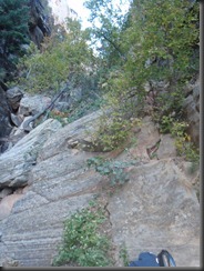
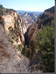
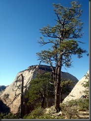
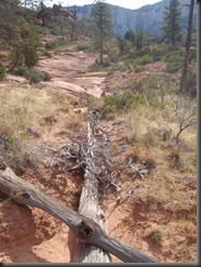
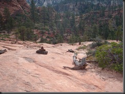
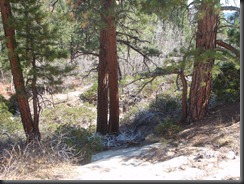
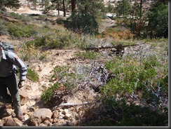
So for those of you who like interesting stories about surmounting difficult terrain, this is going to be a different take on that concept. One of my big projects in 2011 was to make sure the Subway was within standard of no more than 2 trails on each side of the creek. This was a major undertaking that included both the top from Wildcat Canyon trailhead and the lower section. The funny part is that the interesting part of the Subway that everyone pays attention to is really actually in good shape. The problem areas are the entrance and exit routes. These areas are generally places where people are not quite paying attention to the scenery and just blazing through to get the job done. This project is ongoing and still morphing into something greater every time I go in the Subway. It started with a June trip with Becca from veg. She helped me realize just how much there is to do. We hiked the whole bottom and found over a dozen areas that were out of standard.PA260955 Then I came back in there with Kelsey and Ian to get a whole ton of work done. Other people like Seth and Suri went in there to work, but I eventually realized that it was too tough for others to see my vision without me there. The lower half was doing better, so Kelsey and I went to the top section and did an overnight in Wildcat Canyon. We changed the focus entirely. We saw that the goal for the upper section was durable surfaces. Since there was a sufficient amount of slickrock out on the upper section, we decided that two trails was two too many. Slickrock itself can be a trail with a good enough system set up. PA260948So we bit the bullet and actually set up cairns. Of course, we knocked a whole bunch down, too, but we wanted to provide a majority slickrock trail into the Subway. The long term benefits are many, but the short term maintenance is going to be incredibly challenging. The erosion just has to stop and we want to get rid of all those ridiculous, unnecessary trails. The problem is that those trails will keep showing up as people will continue to follow the way they know. PA260967The major problem area I am sure will be the forested area. This is completely unnecessary. There is an easy slickrock ramp just to the right. This is the “easy” way though and I am sure it will take years to get people to use the slickrock, but we had to try. This was confirmed as Derrick and I came back one month later at the end of October to see how the route looked and to GPS the correct route to access the Subway. We were amazed to see how good it looked. Many of the areas that we blocked off were now in great shape. The only area that wasn’t was the forested area. This area Derrick and I increased the debris to a level that people would not mistake it for anything other than asking people to not use it for access. Will it stop anyone? Probably not in 2012, but by 2013, it should be gone. Subway Access
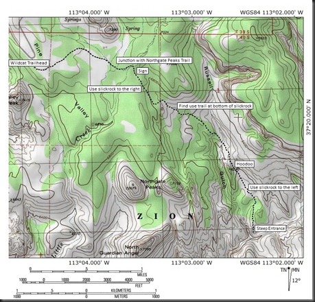
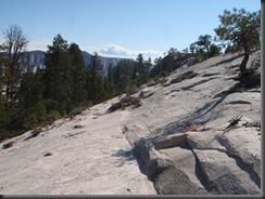
Above is an accurate map of the correct Subway access route. This map as you can see, follows a large percentage of rock (white area). It would be interesting to compare it to the old route, but that rock provides long term erosion control. When there are 80 people a day with a significant lack of wilderness skills accessing this area each day in groups up to 12 people, a long term solution is only necessary.PA260968 So for those of you looking for an interesting story about some way to enjoy the wilderness, I am sorry that instead you got something preachy from me. But I am so excited about this project. 10000 people enter the Subway every year and yet it is still supposed to keep its wilderness character. I love this part of wilderness management as there is always more that can be done to bring it closer and closer to wilderness. My goal is that someday, the top can be 75% slickrock hiking access and that the lower section only has one trail. PA260960This is still a dream, but every time I go in there to work, it looks better than it did when I was in there the time before. If a small staff of 3-8 people can erase a majority of the impact of 10000 people a year for decades in one year, I am interested to see how well we can do with another year to attack it. It just goes to show that you can make a difference as long as you have a goal in mind.
To be continued…
Sunday, October 23, 2011

Tallstack Canyon

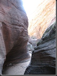
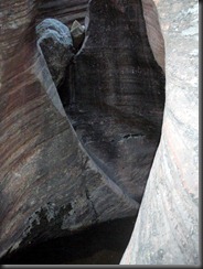
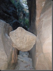
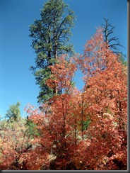
Jacqueline, Zyla, and I went out for the day on the east side. We wanted to get some fall color shots. Just about the time that we got to the trailhead, Zyla decided to throw up.IMG_2381 Now this was not a spontaneous event as the little one had been sick during the week leading up to this. We thought that she was better at this point, but we learned the lesson the hard way and now the car was doomed to smell like baby puke. We still could not miss the fall color and give Zyla a chance to be outside, which is always one of her favorite places. So instead, Jacqueline wandered up Clear Creek taking pictures, while I stayed with Zyla gathering rocks. We had a fun time hanging out and after a long time, mommy came back and took a turn with little Z.IMG_2394 From where we were parked, I decided that hiking up a little known canyon next to the Many Pools hike might be a good idea. It was not the best idea because frankly it just intrigued me for more. As soon as I got into this canyon, I wondered why I had never entered it before. Tight, narrow, colorful, excellent were all words that I could use to describe it. When I got back, I told Jacqueline she had to come check it out. We talked to some folks along the way and a visitor from Vegas said that, “oh yeah, that’s one of my favorites” that he used to hike up when he was younger.IMG_2412 Well, that sealed the deal and I was definitely going to have to come back sometime soon. That sometime soon turned out to be the next morning as the allure of unexplored territory could not keep me away long. I felt an early morning start would be the best, so that is what I did. I was on the road before the sun could even come up. Along the road, I saw a whole bunch of bighorn sheep. They had about an hour before the throngs would be out and they would have to scurry to quieter ground. I started the hike, retracing my steps to the place I was just yesterday.PA230209 On this day, though, I had more time and no sick child to worry about. The canyon was sandy at first before getting to some pools that I had to go high above to avoid. Then came to a section where it looked like this might be a quick end to my hike. But a 3rd class scramble to the right lead to a ledge that eventually dropped back down into the canyon. The obstacles from here were easy enough to deal with while the canyon stayed tight. As soon as I would get to a place where it seemed like this would be it, I would find a way around the difficulty. PA230221Especially in a narrow canyon, you expect to not be able to continue for such a long time, but it just kept going and going with excellent narrows. Finally, I though, there was a place where a big rock jam about 12 feet high would keep me from continuing, but no. I was able to sit on a log and shimmy my way up until finally gaining the top and continuing on even farther. I would run into a big pour-off, but the right side had a sandy slope that worked also. PA230227This was starting to get ridiculous as I wondered why such an interesting canyon would be so unnoticed. Finally, I hit an obstacle that made me turn around, but by that point, I was almost out of the canyon! And frankly, it was nothing insanely scary. It was just about an eight to ten foot rock wall. It just was one that I thought would be foolish to attempt to climb when I was by myself so far from any roads. I immediately knew I had to come back to check out this canyon from the top sometime.PA230224 I had to retrace my steps carefully and I knew that it would be a challenge in itself, but I had no problems and could really enjoy how untouched this place really was. I knew that it wouldn’t stay like that with so many people searching Zion for this exact place. It is a non-technical canyon accessed directly from the road. I wondered why no one had visited it before? Well, looking for a route description online, I was only able to find one even mentioning it. It discouraged visitors from hiking it saying you could not get too far and it was not interesting. I am not sure if that is a cover to keep this place to itself, but if you have a little bit of an adventurous spirit, this canyon has a lot to offer.PB020974 A few weeks later, Seth and I went on a patrol of the East Rim. We had to take a break around lunch to see if we could find the head of the canyon. We did very successfully. It looked beautiful and intriguing. We planned to make a descent sometime next year. I like the name Tallstack better than West Molar, by the way and hopefully this one will stick with this beautiful, pristine Zion Canyon.

Wednesday, October 19, 2011

Where I almost died

Okay, so I know there are many of you out there that just look at the pictures and do not read the story. Obviously, this one will be a little different as the pictures can not tell the story. It started out as just a beautiful fall day in Zion National Park. I was completely stoked because Seth and I were getting to do a new canyon for the first time.PA190160 Lodge Canyon starts on the east side of the park, yet finishes right at the RV campground at the Lodge. We knew the beginning portion well enough as it started at the entrance to Spry. We trudged up the mountainous amount of slickrock, finding the highest point easy enough. From there, we tried to interpret our route description, but were unsuccessful, climbing up too much slickrock rather than continuing the descent toward Spry canyon. We figured it out quickly enough and soon were descending into Lodge canyon.PA190164 I was happy that we had waited until October as the canyon was cool enough to be fun with fall colors even emerging. The canyon stayed non-technical for such a long period of time without even a downclimb that was challenging. Instead, we were surprised to find ourselves popping out above the Lodge with a view down into the Zion Canyon. We decided to have lunch even though it was still just eleven o’clock.PA190166 We sat right on the edge and really soaked up the view assuming that we had all the time in the world as there were only 6 long rappels to finish up before we would walk out. We took our time with lunch before sauntering over to the first rappel. We were not quite sure how long the first rap was, but we knew it to be longer than 100 feet so we tied our two coiled ropes together and chucked them down.PA190169 We both looked over the edge to see a blue rope at the bottom and thought, great one of our ropes was down but not the other. I decided to go first and got clipped in with my prussik on the rope. I started on rappel, looked down and sure enough the blue rope was on the ground, but the orange rope was hung up on a ledge about halfway down. I let Seth know that I would be stopping on that ledge to manage ropes. What I didn’t know was that it was not the orange rope I would be managing on the ledge. Instead, I took a look at my blue rope on the ledge and saw, oh no, I only have ten feet of blue rope left! Without a knot in it, if I would have continued ten more feet, I would have rappelled off the end of my rope! That picture above could have been the last picture taken of me as I easily would have fallen a good sixty feet from there. What happened to put me in that position? Looking down from there, I could see a blue rope on the bottom. It seems that somehow, two blue ropes were coiled together to look like one 200 foot rope. In our cache we have one blue 65 ft, one blue 135 ft, and one 200 ft rope. Somehow we had obtained the 65 and the 135 and right now I was trying to do a 130 foot rappel with a 65 ft rope. I would love to say that cooler heads prevailed and we figured out the right fix immediately. It did not happen that way. We thought about ascending back to the top, but after a few minutes of trying to ascend on prussiks to the top of that canyon, I knew we were going to have to come up with a better solution. Luckily, I was on a ledge, though, and together we came up with a plan to fix one line than tie the rope off above creating one fixed line. From there, I was able to descend a single strand, tie the rope at the bottom to the 200 foot orange rope we had and allow Seth too descend on a double strand. It worked beautifully and soon we were committing to a canyon with three oddly sized ropes. I was a little unnerved by the experience, but felt fortunate to walk away in fine shape. We walked over to the next rappel that was the one I was concerned about before the incident above. It was a big awkward sloping monster of a start. Seth went first this time and luckily we had enough rope to not worry here. But still there was an awkward charade of webbing that lead to a daisy chain in, hook in ATC, slowly lower down as far as you could, unhook daisy chain as you hoped the worn tread on your shoes would grip (except for a brief heart stopping slip it did), lower yourself down the rope onto where you were finally on rappel just to avoid a place where ropes would get stuck.PA190174 The drop was fine and we continued down a couple more easy drops after that. Then we got to the fifth rap. You had to rappel halfway down rap four and get off rappel or else you would have a huge 600 foot rappel. We did that fine. We had to climb across to a small ledge over a precipitous drop. No problem there. But looking at the anchor, it was a two bolt anchor with some webbing hanging over the edge. You were supposed to downclimb that webbing to even get yourself on rappel. To add to it, this rappel was 190 feet and with our ropes, that put us at a disadvantage. After thinking about it, I decided that I would go down first on a single strand from the first two bolt anchor to see how long the rap truly was. Then Seth would re-rig, tying the second rope to it, then downclimbing onto rappel. I definitely left Seth with the more difficult task as I had an easy time single stranding the long drop with a little extra friction from a carabiner. I was also able to see that there would be no issues as a second two bolt anchor was halfway down the drop. Seth with his mad skills, though, was somehow able to take the knot down with him to give him two strands all the way down to where I was standing. Somehow the math was not adding up, so we had to assume that these drop distances were not actually measured. We hoped that the next one would prove to be the same as the last rap was supposed to be 170 feet to the canyon floor. When we threw our two ropes and Seth got on rappel, he looked down and sure enough both ropes were on the ground, though one was hung up in a tree. We fixed that and after the rappel we were done. At 5:00pm! The canyon had taken us 5 hours for 6 rappels.IMG_2340 That is not very good time, but frankly, we were happy to be safe with what could have gone on in that canyon that evening, I was happy to back home to my wife and child that evening. The one lesson I learned out of this experience is always put a knot at the end of your rope. It take 15 seconds, but it could save your life. I will make sure to do that in the future!

Friday, October 14, 2011

Savin' the Day

Well, we finished our week of vacation, which meant it was back to work. Luckily, doing my job, I tend to participate in the same activities that I engage in while on vacation. This week was no different as Dad was joining me for a West Rim expedition. With two days to enjoy the trip, we started from the Wildcat Canyon Trailhead instead of the West Rim Trailhead. Derrick dropped us off, but decided that he had better things to do then to hike with us. That was okay because I immediately put Dad to work blocking social trails on the Wildcat Canyon trail. We got a lot of work done and I was pretty confident that the
work we did would last into the spring. The colors were already coming out on the trail. This is always my favorite time of year to hike Wildcat because all of the oak turns into a colorful display. We were a little early for great colors, but it was nice to have some. We were hiking along minding our own business when I heard some voices. We stopped and listened. We heard them again. At this point we were about 3.5 miles from the trailhead and nowhere near any well known routes. They did not seem to be in trouble, but I had a good feeling they were not where they wanted to be. There was a wooded canyon below, so I threw down the big pack and scrambled on down to their location. I popped out of the woods to see a group of six men and women in their early to mid twenties. They were happy to see me and explained that they were trying to find the Subway. They were only about 2.5 miles off course. They explained that
they wandered down this canyon thinking it could be an entrance. They climbed down to where there were some
bolts and decided that the rope that they had would not make the drop. They were able to scramble back out, but were indecisive about which action to take to get out of the canyon and to get to the Subway. After I checked out their little canyon to see what it was like, I hiked them back out to the trailhead. I told them that any attempt to do the Subway today would be very foolish and to save that for another trip. They reluctantly seemed to agree with me and thanked me for assisting them. You just wonder how many times something like this happens when we are not out there. They could have got themselves in some serious trouble if they kept going down that canyon and who would have thought to think that they would be that far off route. We continued our uphill climb until we reached the West Rim trail.
From there, only one mile on the trail, we found Campsite #9 which was the only available campsite when I booked it for the trip. We enjoyed our evening playing some cribbage and hanging out. We were up early in the morning to continue our trip. We had all the excellent views down into the Left Fork and Right Fork from the West Rim to look forward too. We hiked along at a comfortable pace when we came into Potato Hollow to find a tent in a very odd place.
They were camped under a big tree in the meadow, not in the campsite. I went over to talk to them. No permit! I informed them that they were in violation, got their information, and continued on the hike. They were polite about everything and I think in the future they will do the right thing by getting a permit and camping in the campsite.
We continued on our way to find that the Telephone Canyon trail looked open.This trail had been closed for 4 years, so this was kind of interesting. We went on the West Rim Trail anyway to see the views. It was a perfect day to be out here where it was warm enough, but not too warm. I talked to a few more backpackers, but the rest of the day was just spent hiking. There is just something so satisfying about this hike. We had lunch near Cabin Springs and then just had the 3000 feet of vertical to descend.
It is all so peaceful until you get below Scout's Lookout to see the masses of people heading out to Angel's Landing. We did not go out there on this day, but I was able to check a Heap's group's permit. They had only done it twice and I was the one that checked their permit both times. They even took a picture with me to acknowledge the experience. We finished it out with enough time to get off of work on time. Dad did great and it was nice to have a dad in his 60's that could still keep up with me.

Saturday, October 8, 2011

Hayford Peak

The plan the entire trip was to hike to the top of Mt. Charleston just outside of Las Vegas. When the weather took a turn for the worst, it dumped a pile of snow on Mt. Charleston.
With the hike being close to 20 miles anyway, Dad and I decided to come up with another option. On Dad's list of peaks with prominence was Hayford Peak also just outside of Las Vegas. It was a little smaller being just under 10000 feet in elevation. We were hoping that the snow would not be a problem with the peak being lower. To get there, though, we had to take a long drive out through the desert. There were many, many miles of washboarded dirt roads before finally getting to the trailhead. We started the slow uphill hike up a canyon. It was rather wide with a trail that was leading us up to an old cabin. We had it to mostly to ourselves as we were out in such an obscure spot heading to a mountain that I would not have even known existed if it wasn't for Dad's list of prominent peaks. In face, I guess it is the 42nd most prominent peak in the lower 48. We were supposed to gain 4100 feet to get to the top, but it seemed like we were just slowly climbing, though a desert canyon can easily make you feel that way. The one group of people we did see talked of the trees that were up near the cabin and soon we were in those trees.
They were nice trees, but nothing irregular, just big pondos. Soon after a couple of miles, we were at the cabin. It was recently restored making it a very nice looking cabin for the location that it was in. From there, we lost the trail and lost our gradual climb. Luckily, though, we were able to lose most of the gear from our overnight packs as we were planning to stay out near the cabin. Our number one goal was to get high and find a ridge that would get us there. We could see a high mountain above us and were heading toward that.
Eventually, though, as we got higher, we realized that the one we were going to was a higher, though flatter one to the north of us. It seemed easy enough to take our ridge to another ridge that would lead us to the top. The climbing was easy with a lot of vertical, but nothing that would make someone nervous. In fact, I don't think Dad dropped the hiking pole the entire time. We were moving pretty good and making good time. Dad, especially considering that he is 61 and had already climbed two good sized peaks that week.
As we got to the final ridge, we got into a bit of snow, but it did not slow us down. With a final push, we reached the summit at a bit after 3:30pm. It was an anti-climatic summit with a view down into Vegas and the many miles of desert that surrounded it. There was a huge radio tower on top. There were also some crazy ice crusted trees that showed just where the freezing line was. We were glad we did not attempt Charleston as above 10000 would have been a lot more difficult.
I enjoyed the register as there were not very many entries but they went back to the 1960s even including the people who installed the giant radio tower. We spent a bit of time on top, but decided to head down after awhile. We disagreed about which ridge to take, but they shot us out where we needed to be eventually. When we got to the cabin, there was a big group of boy scouts setting up. We quickly decided to let them have the cabin. We went down the trail and there was another group setting up. We let them have that area as we were just hoping for some sleep. There were some people heading up also and when we finally found a place to camp, there was even another group going up. I had no idea that this cabin was so exciting, but it was going to be a happening place. Our small group, though, had to quickly make dinner, get camp set up and make it to bed after dark. In the morning, we were up early and were hiking down canyon in the chilly morning. We got back to the car in good time, but the slow drive on the road seemed to take forever. I was glad we were able to make it to the top of such a prominent peak and it was a good end to a full week off of work.


Friday, October 7, 2011

First Creek

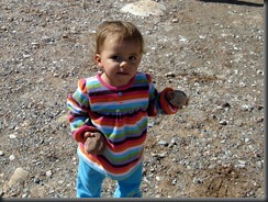
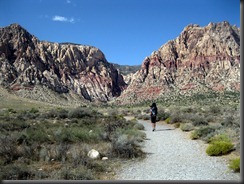
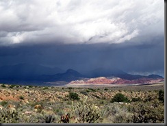
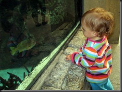
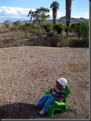
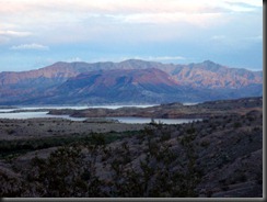
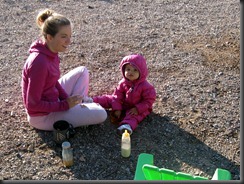
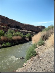
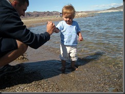
We had been debating about what to do on this day because the weather looked so bad. If we had not been on vacation, we probably would have stayed in and watched movies. But since we were on vacation, we had to get in and do something. Waking up in Primm, NV does not lead one to many outdoor choices. We thought about the Mojave Preserve, but even the campgrounds there were at too high of elevation and would leave us with a chilly night. So instead we headed over to Las Vegas. We figured a good, easy place to hike for the day would be Red Rocks. WeIMG_2186 got to the trailhead a little before 11am. Zyla was so happy to get outside. In the hotel room in Primm, she had been going to the window and saying “side”. This trip had definitely been successful because she was truly enjoying going outside. The trailhead we went to was First Creek. It was a good choice because we did not have to go into Red Rocks and pay an entry fee.IMG_2193 It was also good because we were still south of the storm. When we looked to the north, the storm was just sitting there looking dark and ominous. But right in front of us was just red rocks and blue sky. We still hiked cautiously staying aware of the dark sky that was not too far away. Zyla was not particularly thrilled to be in the backpack on this day. It was just too many days in a row for IMG_2194her to be super thrilled about it. The hike was rather short taking us through open country until we eventually came to First Creek. We followed that until it took us into the cliffs. The trail ran out after a mile and a half. We could have bushwhacked, but were not feeling it. A three mile roundtrip hike got us back to the car with plenty of time still left in our day. We thought about how we wanted to best use our day and hiking was just not a large priority. Jacqueline mentioned the aquarium at Mandalay Bay and it was decided upon. IMG_2203I was surprised just how into it Zyla was. She loved all the fish and animals. She ran back and forth inside the glass room. It was expensive, but worth it though Zyla will never have actual memories of it. Mandalay Bay was in a good location also because it was just on the edge of the strip. We were able to leave easily and go to our actual destination on this night, camping at Lake Mead. We asked the lady at the entrance gate which campsite would be the quietest. She recommended Las Vegas Bay. There used to be a marina there, but with the Lake going down, it now is closed. WIthout being able to launch their power boat, people stayed away. That was lucky for us because there were abundant campsites just minutes from the big city. IMG_2219Zyla was stoked to be free to run around for a while. There was just so much fun stuff to do while camping. Our site was huge and it allowed her to run all around picking up rocks and when she got tired, chilling out in her chair. This was definitely a good spot as we were able to spread out and get ourselves organized for the evening. We got the tent put up, ate some dinner, and then got Zyla ready for bed. Jacqueline was worried about the weather conditions, but I assured her the tent would warm up. We PA060170enjoyed a sunset on the lake with a great view from our campsite. Zyla would be sleeping in the Pea Pod for the first time tonight, or as I liked to call it, her baby bivy. She did great just as long as Jacqueline and I stayed quiet. It meant for an early bedtime for the two of us, but that was not such a bad thing. The temperature turned out to be pretty comfy with the three of us in there. The morning we awoke to was chilly, though. Luckily, we had bought Zyla a down suit to run around in. IMG_2229She was warm and comfortable in that. This day we were up for some easier hiking around Lake Mead. One left from the campground to go to the top of a little bluff. It was a short, easy hike but still long enough for Zyla to fall asleep. It made us appreciate protection of wilderness as the views were that of the lake and the resort that was right outside the park. IMG_2237We were able to get some good views of the lake and saw an egret, but it was hard to truly appreciate this when you are so close to civilization. We finished that one and went on another hike that lead us down to Las Vegas Creek. IMG_2248This creek was probably the reason that Las Vegas was on the map, yet now it was so polluted that there were warning signs all around that warned us not to go into the water. Such a shame as it was a rather large creek. After this we decided to bail on the hiking as it was not impressing us too much. We went and had lunch by the lake. Zyla really enjoyed this as she once again got to run around and play. She even got in the water and was really excited by it instead of being afraid of the cold. The lake was actually pretty warm from the heat of the summer. IMG_2263We thought that this would be enough for the day. After today, the family would be leaving and I was to meet up again with my dad to climb Mt. Charleston. From the way that the snow looked on Charleston, we wondered if that was going to happen. But at least the weather was good, so we could at least do something. The three of us left to find the hotel, which was no easy task.

Wednesday, October 5, 2011

Second Options

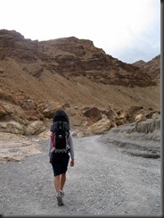
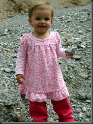
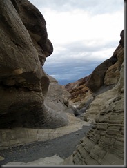
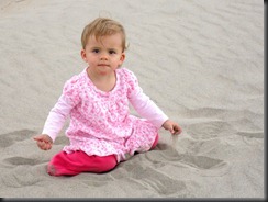
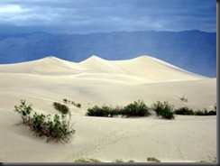
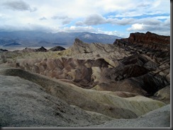
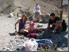
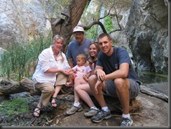
Having checked the weather in Panamint Springs the night before, we were disappointed to find out that the Sierras were expected to get a couple of feet of snow. Considering our reservation at the campground in Yosemite Valley, this put a hitch in our plans. We immediately bailed on the idea of going to Yosemite and instead had to come up with other options. We stayed in Stovepipe Wells, but because of the heat had avoided the Mosaic Canyon hike. Now the temperature was down to a more comfortable level, so it was now time to check it out. We did the drive and the trailhead was rather full. We talked to some people who had an Xterra just like us.IMG_2119 The whole canyon would prove to be a rather friendly experience as we ended up having conversations with many different groups, mainly couples. The hike started as every other hike in Death Valley, going up a canyon that was fairly open. It quickly changed into a slot canyonesque experience where we were climbing over some semi slickrock in a sort of narrow canyon. It was definitely pretty with the variation in rock types that helps make Death Valley so diverse geologically. This slotty section only lasted for the first mile. After this, it opened up to a big giant open drainage again. We decided it might be a good idea to let little Z run around for a while. She was starting to get tired of being in the backpack. I did not blame her because it had been nearly every day. Her little chin showed the sign of it as rubbing against the backpack had created a slight rash on her chin. She was not quite ready to get out and walk with us yet, though, so we just gave her extended time playing with the rocks.IMG_2140 I am glad that we have a child that is so easily entertained because she could have played with rocks, dirt, and sticks for hours. We gave her quite a bit of time and then continued on our way up canyon. Neither of us were feeling incredibly ambitious on this day, so after about another mile we turned around. Supposedly this one went for a long time, but the most interesting part was in the first couple miles. IMG_2145We talked to some people coming down and their stories from above were noted  very convincing, so we decided to head back down canyon and give Zyla’s chin a break. Our next stop was not very far away, though. On the other side of Stovepipe Wells are the massive sand dunes. Having been there before, I wanted to take Zyla and Jacqueline to check them out. Besides, for a kid that can like dirt as much as mine, she was sure to appreciate the sand. I was right because she was totally into the sand. IMG_2163 I was surprised at the numbers of people wandering around on the sand. I guess on an overcast day with high winds expected, this was the thing to do. The three of us walked out onto the dunes together, but I left Jacqueline and Zyla to play in the sand while I wandered toward the main dune trying to get a picture with no other tourists in the shot.IMG_2167 It was a tough shot to get, but eventually they all got out of the way and I got a picture. There is just something so cool about sand dunes. We got our fill of sand time and had a little lunch. Then it was back in the car to head down south. The winds were just whipping away as we got to Furnace Creek.IMG_2175 Our only stop this time was to get out at Zabriskie Point to get hammered by the wind. I was not sure when we would get back, so I wanted Jacqueline to see this sight. We each went separately to the point and got slammed by the wind while Zyla slept comfortably in the car. This day would end with a long drive to Primm, Nevada where we would reload and try to figure out what to do in rain and the wind.
Tuesday, October 4, 2011

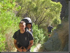
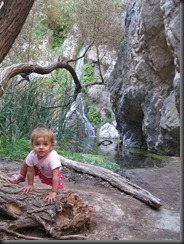
Water in Death Valley

We had grandiose dreams of going to the Racetrack for our 3rd anniversary  where the rocks move on their own (or by the strong winds during rain events). We tried some dirt roads for a while and found out that it was going to be an entire day of driving if we continued with this plan. Having already been to the Racetrack, I did not feel the need to go back. So instead, we drove back down the road and made our way to the Darwin Falls trailhead. This was down a shorter dirt road and much nearer to Panamint Springs.Fall 2011 024 (2) We arrived just in time for lunch. After lunch, we left the trailhead and started hiking up the dry wash. This was like any other hike in Death Valley except this wash was more open and we saw a lot of old pipe around. After less than a mile, the wash began to change and we saw water for the first time. This is the only hike I can think of in Death Valley where we had water on the hike.IMG_2078 I carried Zyla as usual and she was just getting real used to being in the baby backpack. I was getting used to carrying 20 pounds of human when hiking also. The trail eventually became more lush and even a little muddy in places. We made sure to not get our shoes wet because we were never sure they could dry out. (kidding of course) Eventually after rather easy walking, we made it to a small stream flowing down the cliff side. This was Darwin Falls. In Olympic National Park, this would not even get a passing glance. But we were not in the rainforest, we were in Death Valley where there is not much water at all. We hung out here for quite some time taking a ridiculous amount of pictures and letting Zyla run around. She was happy for any time she could get out of the backpack as typically her parents were too eager to see more than let her have unlimited time out of the backpack. I checked out if you could get above the falls.IMG_2083 I determined that you could, it would just take a little more effort than this group wanted to make on this day. I climbed around on the cliffs and let Zyla have her time running around. Eventually we met our quota of 50 pictures of Zyla, so then we headed back down the way that we came. IMG_2086We went back down to Panamint Springs for an anniversary dinner shared with Dad and Laura. It was the worst service and the most overpriced meal I have ever eaten. To top it all off, the food was worse than any roadside diner. Supply and demand at its best. I guess you do what you can do when you are in a place as inhospitable to humans as Death Valley can be. Happy 3rd anniversary Jacqueline!