Tuesday, August 18, 2015

Mt. Gladys

Jacqueline gave my dad and I one night to go backpacking. It wasn't much, but we would have to take it as she did not want me gone for very long. I let Dad do the trip planning as we were going to be doing the trip around Olympic National Park near where he lived in Port Angeles. He chose a trip out to the Flapjack Lakes in the Staircase Area. This involved a drive down the 101 to the trailhead right near the Ranger Station. There was really only one choice of trails to head up from there. It went right up the Skokomish River. There was another on the other side of the river, but that is not where we were headed as we took the junction right near Spike Camp. From there the trail continued uphill gaining quite a bit of elevation quickly. There were quite a few people out on the trail below Spike Camp, but once we were on the trail heading up toward the Flapjack Lakes, we only ran into a few other people. Dad began to feel as if he was slowing me down, so he encouraged me to continue on up to the lakes where he would meet me up there. I was happy to do that and I immediately put some distance between him and me.
As I was rolling along, I came around a corner nearly face to face with a black bear cub. The cub looked way more scared of me than I was of him. He immediately took off and within seconds had scrambled quite a distance up a nearby tree. My first thought was where is mom. I moved quickly to get out of the situation while also looking for the mother. I found her further on in the woods with a second cub. They seemed a safe distance away, so I snapped a picture of the cub in the tree before getting out of the area. By the time Dad made it there, the bears were gone and he never even saw them.
It was not long before I made it to the lakes. Dad followed getting there not too much long after I got there. We chose a campsite and set up the tent. I did not stay long though and instead I took the opportunity to head up to the Gladys Divide. It was a trail, but an unmaintained one that went up to the pass in between Mt. Gladys and Mt. Cruiser. This was where the mountains were as most of the trip so far had been in the forest. The trail climbed pretty rapidly, but there were great views over to Mt. Cruiser and Mt. Lincoln. I enjoyed just being up here as this was a short trip, so I did not expect too much from the two days.
The fairly good trail led me all the way to the Gladys Divide that gave me a chance to peer down below into the basin that became the Hamma Hamma River. I thought about how it would be a lot of fun to hike on through here down into that drainage and come out the other side. Instead, I followed a faint trail that continued to lead me to the summit of Mt. Gladys. This took a bit of negotiating through some rocky sections and tree covered slopes, but the way was not too difficult. It was a class 2 scramble at most, but it still felt good to be standing on the summit of a peak. I wished that Dad could be here and I knew that I would encourage him to give it a shot in the morning.
I enjoyed the views from the summit which gave me a chance to see many other rugged peaks of the Olympics. For such a small mountain range, the Olympics sure had many challenging summits. There was nowhere left to go at this point than to continue back down the mountain, to the trail, and back to spend the night at the Flapjack Lakes. We played some cribbage and read our books. In the morning, Dad did get up early and hiked up to the divide. I was glad that he made the trip up there. The hike back down the trail to the trailhead was uneventful. Nothing quite as cool as the view from Mt. Gladys. Defintely worth the time and energy it took to get to the top of that fairly easy summit trip.

Thursday, June 18, 2015

Loop around the Three Sisters

Well it was Tuesday, but this Tuesday was so much better than last Tuesday because on this Tuesday there was finally no school! It had been a long and tiring school year. My students definitely tested me, but I came out okay and enjoyed teaching them. It took me a while to warm up to some of the other teachers, but Jacqueline and I had formed some friendships with other staff members by the end of the year. Mainly it was the driving the children back and forth from day care every day and the many dark and rainy days that had accumulated. To this point, I had spent my life mainly being a wilderness ranger at Zion so getting out and about was a necessity, not a privilege.
It now became a privilege in my life so as soon as school was done, I was going to go after the first backpacking trip that I had been dying to do which was the hike around the Three Sisters. I talked to the person at the Ranger Station and they told me that there was still a possibility of some snow on the route, but given that it had been such a dry year as far as snowfall accumulation, I would probably be okay. The great part about this trip was that it was a loop hike. It might be a long loop hike, but it was still a loop so figuring out a car shuttle was not necessary. It started with a drive up the road to McKenzie Pass which had just reopened after being closed for the winter.
I parked at the Lava Camp Lake Trailhead and then I was off on my way. It felt so natural to have a heavy backpack on my back and moving up the trail. The first interesting feature that I encountered was the Matthieu Lakes. There was a north one and a south one and both of them I arrived to after hiking through an alpine forest that was right on the edge of a massive lava flow. The lakes looked awesome and it seemed like a great place to hike with the kids in the summer time. Right after the South Matthieu Lake, the trail split at Scott Pass. I took the eastern route to the left that put me on Scott Pass Trail. This trail descended pretty quickly and soon I was hiking in the burned area.
This had supposedly burned a few years back. Because of the burn, the view was actually okay and I had views of the North Sister which of the three was by far the least scenic. After a couple of miles, I took the Green Lakes Trail which was just a long trek through a burned out area. It was rather warm, so I was drinking lots of water. I was happy when I finally found a stream to filter some water. Eventually I made it to the junction with the Pole Creek trail which lead me to another junction with the Camp Lake Trail. I looked at Camp Lake on the map and it sure looked like it was in a great spot with the North and Middle Sister right beside you.
 I saw one of my only other groups on this day hiking with telemarking skis up to Camp Lake. I did not have time for the hike to Camp Lake on this day, so I continued on my trail toward Park Meadow. I did not actually make it all the way to Park Meadow, but it was getting to be around dinner time, so I found a nice spot to camp right near a small stream. I found a flat spot away from the stream to put my tent down and I was luckily out of the burned area that I had been hiking in all day. With that, though, came the mosquitoes and they were out, but not nearly as bad as I guess that they can be this time of year.
I got the tent up, made dinner, and still had quite a bit of time and daylight on my hands given that it was the middle of June. So I got a good few hours in of just reading my book which was on the relationships between former U.S. Presidents. I got a significant amount of sleep and then I was ready to go early in the morning. I was moving before 7 AM and quickly made my way to the junction at Park Meadows. I saw one other tent camping there, but after this the trail began to climb and I was really getting my share of the views. Yesterday it was mainly the North Sister and Mt. Washington. Today, I got to see new mountains like Broken Top that were still covered in early season snow.
 The views of the Middle and South Sisters were starting to open up also and the trail quickly got me to a junction. There was no marking, but I knew that the trail went over to Golden Lake. I decided to take it since it was not very much out of my way. It was well worth it because the view from Golden Lake with Broken Top in the background was amazing. I was really enjoying these sub-alpine meadows that were now everywhere in this non burned area. I decided to make my way back to the trail by just cutting over and though it took some effort, it saved me some time and I was back on the Green Lakes Trail.
This is where I encountered snow and while it was not deep, it did make the trail hard to find in some places, so I really had to keep my eyes open which was unfortunate because the views of this side of the South Sister were fantastic. At this elevation I could see all of them and I took way too many pictures of all of the area. The hike was already worth my time to just be here. After I peaked out on the pass I was hiking to, I could see down to what was finally the Green Lakes that was the name of the trail that I was hiking on. I could see why you would name a trail many miles away after these lakes.
They looked amazing and with views toward Mt. Bachelor it looked like this pristine spot. The Green Lakes did have this amazing green coloring to them with green grass surrounding them in a sea of volcanic rock. I was amazed that there were no other people camping here and I felt like I had the place to myself given that it was only 9 AM. I filled up on water and enjoyed it until I got to the far end of the smallest lake which was where I started seeing the people. Until now, I had been nearly by myself. Hiking down from the Green Lakes along this ideal stream next to a glacial moraine was amazing but it was made a bit less exciting by the fact that it seemed like everyone was hiking up to the lakes.
I had a tough time having more than a minute or two before the next group was coming. When I looked at the map, I could see that I was only about 4 miles from a trailhead coming in from the Bend area. It turned out that this was one of the most popular trails in the Three Sisters area. I was happy to find the junction for Moraine Lake which to me was one of the highlights of the trip. As I found a place to sit and have some lunch, I had the place nearly to myself. I already felt like the burden of the school year had been lifted off of my back and I was in this entirely different environment with an entirely different me.
I was only halfway done with my trek, though, and I needed to continue on. I passed the South Sister Climber Trail that I had taken many years ago and then it seemed like everything got weird. The trail descended rapidly and it felt like I was going the wrong direction for a long time. The map said only 1.5 miles, but I was losing so much elevation and just second guessing myself considering the many ways that I could go wrong on this network of trails south of the South Sister. When I finally hit the LeConte Crater Trail, I was relieved, though this trail was such a different world from where I had woken up in the morning.
It was this nearly barren landscape of low shrubby grass and it was hot also. I felt the burden of the pack in the heat as I hiked this trail to eventually meet the PCT. It made sense to me that this was the section that was the most volcanically active given the significant lack of moisture and vegetation. As I climbed toward the PCT, soon that landscape melted away and I was back to the meadows and greenery surrounding me. It was peaceful to watch the deer running through the meadow or to cross a small cut log over a meandering meadow stream. The trail climbed pretty rapidly from this point and soon I found myself back in the thick forest.
After the next junction, I felt like I had put in enough miles, so I found myself a nice spot to camp by a small pond without a significant amount of mosquitoes in the late afternoon. It had been a full day of hiking and I estimated I had done another 17 or so with a full backpack on. That meant an easy dinner and a few hours of daylight to continue enjoying some alone time reading my book and resting up for the next day. I was up plenty early again and was moving once again before 7 AM. I would spend all day on the PCT and my views were just dominated by the South and the Middle Sister.
I began my day right on the flanks of the South Sister, but was quickly moving toward the Middle sister through a series of forested areas transitioning to beautiful meadows. They seemed never ending on this day and soon I was hiking into the areas that were enjoyed by not just hikers, but mosquitoes also. They were the worst across from Separation Creek Meadows and I felt bad for the tents of people I saw camping here. I talked to a few other hikers and backpackers on the trail and they seemed particularly bothered by the mosquitoes.
It was not too bad for me as long as I kept moving. I could spend hours talking about the amazing trail and the amazing views I saw, but it was truly endlessly enjoyable to hike this section. The elevation did not change much and the mountain views were spectacular. I was impressed by a mountain I did not even know much about which was the Husband. I had camped near the Wife yesterday and soon I would be passing by Little Brother also. It was a whole family of mountains. The terrain was becoming a bit more volcanic and the meadows were melting away, but I began to notice pieces of Obsidian on the ground.
 I knew I was coming upon the Obsidian area. It was amazing. Obsidian was everywhere. Usually you are excited when you find one or two pieces. Here it was in all the rocks, scattered everywhere with huge outcrops of obsidian. There was even this amazing waterfall pouring down from the cliffs above. The scene eventually led to this large plateau with small lakes scattered amongst the piles of shiny black rock. Then I come around another corner and here is this breathtaking view of the area between the North Sister and the Middle Sister.
The obsidian area required a special permit, but the view from the PCT was remarkable in itself. I could see why this was a special protected area. The trail dropped pretty rapidly through forested area after this point and eventually it found its way to the most volcanic area of the whole hike. Here you could tell that this area was once a lava flow as every step was over some blob of basalt that had been shuffled around to make a trail through the rocks. The views were remarkable, but the hike was challenging carrying the heavy pack up the loose rock as I climbed steadily to Opie Dilldock Pass which was named after a comic character in the early 20th century.
I was happy to top out and get the views, but even happier to start going downhill again to get out of the open exposed rocky pass. It dropped me down into more meadows that I was able to follow until the junction with the Four in One Cone Trail. I had one more short section of trail that took me once again through the lava flow on the flanks of Yapoah Crater and then I was back to the Matthieu Lakes. I took the opposite trail from the one I hiked in on which was kind of a mistake, but kind of not to because it had a bit more up and down, but it gave me a different view then I had encountered on the way in.
The last few miles seemed to take a long time, but eventually I was back at the Lava Camp Lake Trailhead to find my vehicle waiting for me. The last day was another 18 miles, so I estimate that the whole trip I hiked about 52 miles or so around the sisters. This trip was fantastic and it had rejuvenated my spirit. I was ready for the next couple of months off of school to enjoy the summer sunshine. 

Saturday, May 9, 2015

Loving Deer Creek

I'm not sure if anyone who is outside the teaching world really realizes just how rough it is to be a first year teacher at any school. If you think that you show up and they hand you a lesson plan that says teach this, that is not how the show goes. You show up and they hand you a classroom and tell you that you are the expert. Then you are on your own. Sink or swim, that is kind of up to you. So you spend hours upon hours working at making each day a better experience for you and your students. The amount of hours you put in and the amount of effort you get back from the other side is sort of not even comparable. So when you get a chance to step away and enjoy some time with the family, you got to take it. We did on this day as we sat on the shores of Deer Creek. I had been running more frequently lately with Corey Culp, our Technology teacher. We mainly ran around school but sometimes we would go up on the McKenzie River Trail which was a fantastic place to run. The section between Deer Creek and the Blue Pool trailhead was particularly fantastic, so I got inspired to take the family up there to hang out on a beautiful Sunday afternoon in May when we did not have to work.
The walk was less than half of a mile and we had to do a bit of bushwhacking to get below the bridge to a nice spot. I even brought a chair, a book, and everything to just spend the day at the creek. It was fantastic. The kids loved it. They dug around in the rocks and even got into the water a bit. It was so cold, but they gave it a shot. They waded in and were braver than Jacqueline when it came to dealing with the cold. It was just a fantastic day. It was so fantastic that we found ourselves back again when our next weekend day arrived. This was a Friday and the weather was just as wonderful as it was the previous weekend.
We brought swimsuits this time and even braved the cold a little bit more. Being by the creek was just so amazing that we began to think about a piece of property that Jacqueline had seen almost a year ago when we were initially looking at houses. I never saw the place and she remembered as a house where the floor was slanting oddly and there was a dead mouse when she walked in. The property, though, was amazing. It was on Dearborn Island which 6 months out of the year, had a branch of the McKenzie River flowing right near the house on the property. We talked to our real estate agent and she said that the place was still available and we could go see it whenever we wanted.
The next day we popped on over and this started the process of us buying our first home. It was an absolutely fantastic spot right by the river and while it took us a couple of months to actually get into the place, it all started because of the enjoyable days that we spent hanging out at Deer Creek.


Sunday, April 19, 2015

Lookout Creek

We had a plan for a family Sunday and I wanted to take a drive up the Lookout Road FS 1506. When we had hiked up in HJ Andrews in November we had driven up that road for a while, but had not continued further. So, this time the goal was to make it up and see what was up high. The Xterra held its own, but it still was struggling a little bit to make it up that high. Soon enough though, we were running into enough snow that I did not want to push it, so we stopped after a bit and parked. When we got out there was a bunch of snow. The funny thing about that was that it was getting into the 70's and 80's every day down by the river. The kids were pretty excited to see snow because the winter had not brought any to our house. So we let them play in the snow a bit and took a leisurely walk up the road. They were pretty happy with it even though we were not really dressed to trudge through the snow. The weather was still not cold, so even though our feet got soggy at times, we were still enjoying it. There is only so far that you can walk with a two and a four year old. We plied them along with snacks as they enjoyed a bag of chips, but after a while we realized that this was a fruitless expedition.
So instead we drove back down the road until we hit the bridge where the road crossed Lookout Creek. It looked like a good spot to get out and throw some rocks. The kids did not have any issue with this as they were always up for a day playing around by the creek. In fact, we had not given them much time for that and they were loving getting to throw rocks and tramp around in the creek. We knew we would have to take another chance to spend the day just hanging out by the river as everyone enjoyed the chance to just play around in the water. Not that exciting of a day, but definitely worth a Sunday afternoon. 

Sunday, April 12, 2015

One Photo of the Louise Creek Trail

After Spring Break, we renewed our effort to start looking for a house to buy. We figured that we would be in the McKenzie area for a while and it was time for us to purchase a place to live. So far, we seemed to strike out on places that we liked, but we had found a place to put in an offer. After negotiations, though, we could not agree on a fair price, so the deal fell through. School was busy as usual, but I was finally able to make time to get out a little bit. There was a trail I saw doing the Separation Lake Trail, so I thought that maybe since it was lower elevation, I would have a chance of getting up the trail a ways. The trail was the Louise Creek trail and although it was a nice trail, the only interesting and different thing about this trail was when I got high enough in elevation, that I was able to see some snow. So, even though the hike was great getting in some miles of hiking, I turned around pretty early in the day because I didn't feel like fighting the snow for too many miles. Oregon was very appealing, the only drawbacks were the similarity in all the trails, so much so, that I wasn't taking nearly the amount of pictures that I normally would given that all I would be taking pictures of were the same trees in a different place.
So here is a picture of the kids and I a week earlier on Easter. Living in Oregon is just so interesting because unlike other places, the view from our backyard was nearly as good as any view that I could hike to. It is good, but also tempting to me to be unmotivated to explore. My next hike, I was going to have to find a way to hit the trail and see more. As the snow would melt, the spring would finally allow me to do a little more of that. 

Friday, March 27, 2015

Camping at Cape Blanco

We awoke to a couple of crazy kids ready for the day's adventure. They so enjoyed the hotel room, but now we were going to take them away from that tranquility and make them go camping. This is not something that we had done often with our children which is strange because we both enjoyed the outdoors so much. Being park rangers, I often had my fill of being outside and did not need another escape on my weekends. As teachers, our weekends were often taken up with grading and planning. So Spring Break was the time to get this done. We drove up 101 which from Crescent City, CA put us back in the state of Oregon pretty quickly.
We really enjoyed this drive which bounced back and forth between beautiful beaches and coastal forests. We stopped in the town of Gold Beach at the Ranger Station to pick up brochures about places that we could visit again in the future. The real goal was to find a place to camp for the evening and that put us around lunch time at Cape Blanco State Park. The weather was absolutely perfect out in the low 60s. It was sunny and not windy, which for Cape Blanco was supposedly rather odd. We enjoyed it and easily found a wooded campsite with lovely green grass to camp upon. Jacqueline got the kids some lunch while I took on the business of setting up tents, sleeping bags, and making everything comfortable.
The kids were really excited and it made camping so much more fun with them being happy to do it. We saw that Cape Blanco had some cabins and thought about how cool it would be to come back in the future and stay at those cabins. We took our time but, by 2 pm we were finding our way down to the beach. We walked down a long road that dropped steeply down to the beach. When we got there, it felt as if we had the place to ourselves. Oregon beaches are quite amazing because there are so many choices that they often are not very crowded. Cape Blanco is the furthest place west in the contiguous United States which is why the winds are so intense, but today there was nothing to complain about.
We had our own private beach to enjoy, so we set out toward the big cliffs on the other side of the beach. Everyone was in good spirits and the kids did well even on the long walk. Once we got to the end, there was nowhere left to go, so we sat down and the kids played in the sand for a while drawing stick figures and mini castles. There was a big jutting rock that made the coastline seem more rugged and I could only imagine just how nasty the waves and weather could be here during a storm. When we had our fill, we made our way back to our campsite for the evening. There were bunnies all around for Jacqueline and the kids to get excited about every time one hopped into our campsite.
We spent most of the evening playing games as the kids helped me strategize on how to beat Jacqueline at Catan. The sunset was semi- good, but also hard to see. The cool ocean air and just the relaxed feel of the campsite made me feel as if I could be here a long time. Unfortunately, though after an early bed time with children, we departed the next day after enjoying breakfast in camp. It was sad for me because I could have enjoyed it much longer. Instead we went into Bandon to do the tourist thing for a while before finally deciding to camp for the night near Florence. It was not nearly as ideal as spending the time at Cape Blanco, but we were able to make it out to the Sea Lion Caves the next day, which was an exciting experience for the kids.
I couldn't believe how many were there and how easy the access was to see them. The noise was overwhelming as well as the smell, but it was a fun experience. Sadly, though this was going to be the end of our short Spring Break trip. It was a fun family vacation and our kids did a lot considering their age. It made me excited for further adventures in the summer time as every month they seemed to be capable of so much more. 

Tuesday, March 24, 2015

Spring Break: Birthday in the Redwoods

We finally made it to that illustrious break that teachers wait for so much more than students, Spring Break. We were sure going to take advantage of it since we had not seen much of Oregon yet. Forget that the weather looked rather miserable and the temperatures were not going to get much above 60 degrees. We were heading out and exploring the country. We had to wait initially for the NCAA Tournament, though as I was not going to miss the opening round weekend. After seeing Gonzaga beat North Dakota State and Iowa, I was ready to head out. We left on Monday morning and our only goal for the day was to get down to Roseburg, only a couple hours away. It was just pouring down rain. This was going to be fine as we were going to spend our time at the Wildlife Safari Park. We had been there once before to the free part and were amazed just how much that you could see in the free part. This time we were going to pay the big bucks and do the drive. It was worth it once as there were many types of animals to see and given that we got to spend the day inside of a car rather than outside in the pouring rain, it worked out. We had a dinner in town and a comfortable night stay at a hotel before heading further south.
We drove down I-5 until we got to Grants Pass, then cut off from there on Highway 199. The goal was to make it down to Northern California and spend the day in the Redwoods. It was actually a fairly pretty drive as much of it was along the Smith River until we were at our goal which was Jedidiah Smith State Park. We drove to where the visitor center was located, but found it not to be open. We hoped to gain some information there. Instead, we wandered down to the Smith River where we ate some lunch and threw some rocks. It was an excellent place to hang out and the kids had a great time.
We needed a trail, though, because we were not going to go all the way to the Redwoods without getting out and doing a hike. So, we found one that was nearby with parking that was actually a loop trail. It did not sound very exciting as the name was the Wellman Trail. It turned out to be exactly what we were looking for. With a 4 and a 2 year old, there was not a lot of distance that we were going to be able to throw down. We built up the hike quite a bit for the kids, so that they were excited to see the big trees. We also could keep them going by playing games with them such as go up ahead and hide to scare people. This trail did have a bit of elevation to it, but also many large amazing trees. The kids really enjoyed the slugs along the trail and I was enjoying the fact that at least it wasn't pouring down rain on us. Jacqueline was enjoying taking lots of pictures while also making the kids hold hands at any possible drop off. Given that this trail was not very steep, that was not very often, so we were able to run free most of the time. The kids did great, but the trail was not very long, so by 2:30 we still had time on our hands.
We drove down to Crescent City which was our goal for the night. We found this amazing playground that was virtually vacant. I guess it helps that the kids in California were still in school. Our kids were able to run around and play for quite a while. The next goal was to find a place to place to stay. Given that it was actually my birthday, Jacqueline convinced me to stay at the place in town that had the best view, The Oceanfront Lodge. It was a bit older but still we had a view of the ocean from our room. We even had a private beach that we were able to go down to in the evening to enjoy. I spent the rest of my birthday hanging out with the family and we had a good dinner. This trip was getting expensive as eating out and hotels were adding up. We needed to spend some time outside camping which would be our next adventure.

Sunday, March 1, 2015

Three Generations of Ladies on Castle Rock

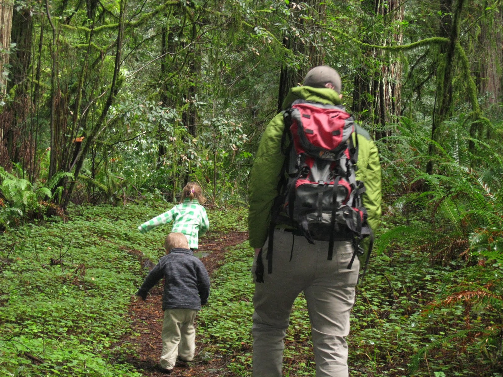
My mom and sister were up visiting the kids. Having an afternoon free, I convinced Jacqueline to allow me to take her and my mom up to Castle Rock. This was my go to hike and a rather easy hike to access given the typically good condition of the road and the short trail. I even convinced Jacqueline to let me take Zyla too. Usually I hiked from the trailhead coming off of King Road, but this time we took the gravel road all the way to the trailhead that was only 1 mile away from the top. The Xterra handled the road fine, even though it was starting to be more temperamental at this point.
Honestly, one of us was nearly always holding Zyla's hand on the hike up and the hike back down. Regardless, she did the walking on her own. The trail has some rather large drop offs in some places, but for the most part it is a wide enough trail to not be an issue. There is some uphill, but we were not trying to break any speed records, so we took it nice and slow. We finally topped out after a leisurely hike up and the view was spectacular. The sky was clear and the sisters were coated in white. We took many pictures as I got photos with every generation. First my mom who had been exercising more lately.
Next, my daughter who was nearly five. Looking at the picture afterwards, I could see how somehow this little girl looked a lot like me but is still very pretty. Lastly, I took a picture with my wife with the sisters in the background. We enjoyed our time at the top of the peak, not taking too much freedom to wander around with a 4 year old. From there, we continued back down carefully. This is such a fantastic hike and so close to our home.

Saturday, February 28, 2015

Hiking around Clear Lake

After a couple of weekend trips up Castle Rock via the King Castle Trail, I decided to mix it up a bit on this last weekend in February. The King Castle Trail was just too perfect. It was steep enough that the trail was a real workout. The forest was awesome and not much different than all the other forest hikes around. It was long and the trailhead was really easy to access. All of those things added up to a great experience and it was now my go to hike nearly every weekend. This one, though, I switched it up and drove a bit further up the road to Sahalie Falls. I would start my hike here because I wanted to get a good view of the waterfalls.
Hiking on the other side of the falls along the McKenzie River Trail, this was quite a better view. I was surprised just how close I could get to the falls themselves. I was basically standing right on the edge of the falls and there were no railings or paved walks on this side. The falls was cranking as the early season melt was beginning. I enjoyed that beginning to the hike but the ultimate goal was to hike around Clear Lake. Jacqueline and the kids had spent a day with me up at Clear Lake a few weeks prior. We just hung out and spent some time by the lake. This day though I hiked up the McKenzie River Trail until I showed up at the outlet which is the beginning of the McKenzie River coming directly out of Clear Lake.
Clear Lake is this phenomenal lake that has insanely clear water because it is mostly all spring fed. The rocks around it are so porous that the water just flows right out of the mountains and into Clear Lake from a huge underground aquifer. The hike around the lake is pretty, but it is fairly flat. It is a few miles so it takes quite a bit of time and the view does not change much. There is a campground on one side of the lake and by far the most interesting part of the entire hike is coming upon the springs where the water comes in. You can tell why it is called Clear Lake at this point as seeing down to the bottom is easy to do.
The lake was amazingly blue and with the perfect sunny day once I got to the other side of the lake I got a great view of Mt. Washington still covered in snow. Well, not much to do except pass through the resort area and complete the loop to head back to the falls. These weekend hikes had become so valuable to me as a way to clear my head to come up with new ideas. Teaching was turning out to be a difficult job but I was hanging with it. McKenzie was a place where they were letting me try new things and so far I was feeling pretty good about the students that I was lucky enough to teach. These hikes kept my head clear and let me attack another week with a fresh head of steam. 

Sunday, January 25, 2015

Olallie Ridge

Three day weekends are awesome because it means that I can spend one day out hiking and still have two days off. Our school had a four day school week and it was fantastic. It wasn't the best for learning, of course, but for weekend adventures it was great. On this weekend I chose to drive the 1993 Road up to the Olallie North Trailhead that would take me up the O'Leary Trail to the slopes of O'Leary Mountain and eventually over to the Olallie Ridge. You would think that in January, this would be a strange proposition, but during this January the base of the trail and the roads were free from snow. That meant that I could hike to my heart's content until I reached the snows above.
The O'Leary Trail is not a friendly one to people just out for a pleasant stroll. It gains elevation at such a rapid pace that it is popular with downhill bikers who can actually access the trailhead from another location on the other side of the road. This part of the road was actually closed due to extensive logging operations and the other way in was too high of elevation to escape the snows. So safe to say, I would not be running into any bikers on this day. In fact, I would not see anybody out here as I may be the only one wanting to see these trails in the winter when they obviously would be much more scenic in the summer time. I knew that I would likely be back in all four seasons on many of these trails, so why not see it in the winter. I climbed steadily with not much of a break. It was a steady push uphill with not much of a break from the evergreen forest and moist ground below. It was perfect weather, which in January one needs to take advantage of. I soon crossed a dirt road and came to a sign that led of in the direction of McLennan and McDuff Mountain. I saved that for another day and instead kept going toward the Olallie Ridge.
I was handsomely rewarded almost immediately with a spectacular view of the Three Sisters cloaked in white with the snows of a winter that had seen plenty of precipitation at the higher elevations. This was a spectacular spot and the only drawback was that since it was so open, I was now going to have to fight the couple of inches of snow on the ground. Still it was not bad and I was able to continue on my way for as long as I could continue to find the trail. The Three Sisters looked amazing and this was the perfect place to take in their alpenglow. I turned a corner and also got great views of Mt. Jefferson and Mt. Bachelor.
I was able to continue on the way until I ran into the trail for Horse Pasture Mountain. Having to fight snow is never much fun, so since I had been to this spot previously, I figured this was a good opportunity to turn around. I would live to fight another day and I was sure that I would return to this point again to continue the Olallie Ridge. Oregon was sure turning out to be different than Utah, but it was still providing me with opportunities to hit the trail and explore places even in the winter months. I turned around and fought the snows back to the solid ground where hiking back to the trailhead mostly all downhill was a piece of cake.