Furlough! It is not always the best thing to not get paid anymore, but a little time off is not always a bad thing. People look forward to their first day of retirement, but I had been looking forward to the first day of furlough. What was I going to do? Well, the same thing I get to do for work, go for a hike in the park. Jacqueline and Zyla were in Arizona for Thanksgiving visiting family, so I took the opportunity to have the day to myself. We had just had Greg and Annette over for dinner. Greg had suggested a hike called Progeny Peak on the east side. This was a route popularized by Bo Beck and Tanya on their website zionnational-park.com.

For a long time I had been resisting these routes since the east side was so easy to explore on its own. With Greg's advice, I finally decided to give it a try. The funny thing is that I had actually done a lot of the hike before. (see
East Side Arch ) I had just never had the urge to try to get to the top of the peak. So this time I had a destination instead of just randomly wandering the east side.
I parked by the beginning to Spry and then just started up the slickrock. The beginning of this hike takes you to the Two Pines Arch, but I had already been there before, so I just went up a different route. It proved not too difficult. I followed the contours of the slickrock until finding a pretty easy slope to the top.

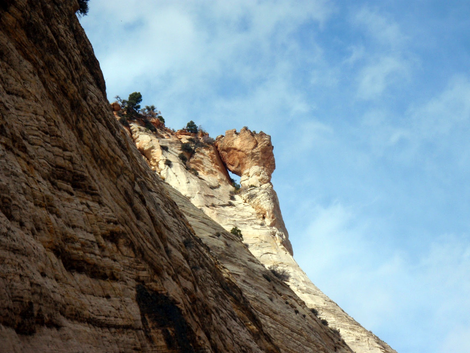
This was such a great route because it was almost entirely slickrock. When I topped out, I found a gigantic cairn and a lot of amazing views. This is really a spectacular spot because you could see many of Zion's most famous peaks. I sat down for a while and went through the summit register where I found Greg's entry and added something to it.

I snapped many photos, but was disappointed to see that there was graffiti carved on the rock. Why does anyone feel the need to leave a scar in the rock with their initials on them. There turned out to be a half dozen different names carved in the rock. Luckily, I was the leading expert on graffiti removal, so I searched the summit for some hardened rock. I found some and bashed it in getting rid of a horrible idea by a not so smart person. I enjoyed the views for a few minutes more, but I eventually all good things have to come to an end.

So, I went back down. I had a bit of trouble finding the way that I came up and got myself into some trickier downclimbing, but it wasn't anything to get too nervous about.
I could look back up and see the arch on my way down, but still didn't feel the need to hike up to it on this day. I did see a couple of other people out there wandering amongst the slickrock. They did not seem to have a purpose, but that is okay. It is funny how when I go on a hike to a place that I think no one else goes, there is always someone there. People are pushing farther out into the fringes of Zion National Park. I am okay with that, because the more people see how beautiful these places are, the more they should want to protect it.

Except for maybe those few people who put the awful graffiti in the rock. I was plenty pleased by Greg's recommendation and Bo and Tanya's route description. I figured the next day, I would give another one of these east side routes a try.

 So I got a fairly leisurely start on this fair November day. The park was just swamped since it was the Saturday of Thanksgiving weekend. Luckily, this trailhead was nice and quiet given that all the people here were doing what I set out to do as a kid and take that picture of Checkerboard Mesa. The route up is to the east of the peak through a very forested area. I was surprised to see a fairly well defined use trail with much erosion taking place. It was easy to follow and with just hard work and effort, I was able to make the saddle between Checkerboard and the hidden east side slickrock beyond it. From there, the trail sort of disappeared making me think that this route was being used as an entrance into Fat Man's misery instead of the route to the west of Checkerboard Mesa.
  A quick scamper got me on top of Checkerboard Mesa. Technically at this point, I had reached my goal and could turn around if I so chose. But, I had to get some kind of view so I braved the thick scrub oak that surrounded the top of the mesa. It wasn't too long before I got myself in a thick bunch of scrub oak, eventually having to turn around and backtrack because the way was blocked so severely. It was on my way out to find a new option around, that I managed to whack myself directly in the open eye with a branch. It was so painful and I thought after a minute it might get better, but my eye just continued to throb and to water. I could barely keep it open and found it much easier to move if I didn't, though I needed some depth perception to make sure I didn't make an error in judgment on where I put my feet.

 When I got back to the car, it was getting bad. I was excited because my sunglasses were there and I could use them to keep the light from really hurting my eye. When I opened, the case, I saw that they were broken. Oh no! I put them on anyway and tried to tough my way through the drive that was a half an hour through windy roads. I would scream out in pain to keep my eye open. The most difficult section was through the tunnel. I literally hyperventilated to keep my eyes open because the pain was so severe. I luckily made it home without injuring myself, my car, or anyone else with my car. I spent the rest of that day and the next dealing with extreme pain in my eye. I guess this should be a lesson to wear sunglasses, but I truly enjoyed that summit and the short hike it took to gain it. I hope to go back again and maybe enjoy the view the next time around.


