Sunday, May 31, 2020

Yellow Knolls


Well our time in Southern Utah was coming to an abrupt end, though our house was still on the market. It was frustrating us a little bit considering how quickly things were selling. We decided to make the best of it, though, and just enjoy our time off. We were now able to hang out with friends again because the pandemic was getting tiring. It wasn't like it was over, it was just not really hitting Southern Utah very hard. Conrad was back playing soccer and the kids were doing tennis again. We invited our friends Amanda and Eric to do a hike. We decided to head out to the Yellow Knolls because the features were so cool and they had never been there before.

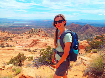
 It was a nice spot and we talked with them while we walked. The kids were with us and they were able to hang out while we conversed with our friends. We were lucky because the weather was unseasonably cool with some overcast conditions. It would still get up into the 80s during the day, but for now we had some cool weather especially since we got an early start which was rare with Jacqueline. The trail started downhill through open sandy meadows. Then went up a jumbled path through volcanic rocks. It then came out to the most unique looking formations of fractured sandstone. It was almost scale like looking like the scales of some giant dinosaur. The kids and I made sure to get our money's worth, climbing all over the scales of these hexagonal fractures. I think it is one of the more unique features in an area full of unique features. After playing around long enough, we headed up the trail more. We only made it to the junction and everyone seemed to think it was far enough. On the way back, we saw a leopard lizard which always made me happy. The leopard lizard is by far my favorite. Other than that, nothing too remarkable occurred. Very happy to spend some time with Amanda and Eric. They are very nice people and we would be leaving behind many nice people when leaving. But we were off to new adventures, as soon as the house sells.

Thursday, May 28, 2020

Francois Matthes Point


Tim and I had a morning to hike something at the Grand Canyon. There were many trail options but having a down and up day the day before, meaning we went down into the canyon and came back up, we decided to hang out on the rim. I had always wanted to get my eyes on Cheyava Falls which is the tallest waterfall in the Grand Canyon. It is a bit elusive and only runs during the Spring. It was Spring now, but likely it would not still be flowing because you need a good bit of snow melt and we hadn't had that lately. I still wanted to give it a shot. 


We figured out that if we hiked out to Frances Matthes Point, we could peer down into Cheyava Falls. Frances Matthes was a photographer in the early days of photography and would popularize the Grand Canyon with some of his photographs. We figured if this point was named after him, it was probably pretty photogenic. We also found out that if we parked on an old abandoned logging road, there would be a path most of the way to the point for us to follow. So that is what we did. The walking was really pretty easy being mostly flat rim trail walking. We ran into a couple of interesting things including a survey marker and an old ladder.

 Mostly it was walking through open forest with not much to fight off in the way of vegetation on the forest carpet. When getting to the point, we had to sort of pick our best route to the edge, but when we did, we were rewarded almost immediately with amazing views of the canyon. This was an angle I had not seen it from before, so it was amazing. There is no good way to sum up the feeling that you get when you look off into the distance in the Grand Canyon. It is the feeling of eternity that this place had been here for millions of years looking very similar to how it looks now, but also the knowledge that it took millions of years for it to become what it is. 

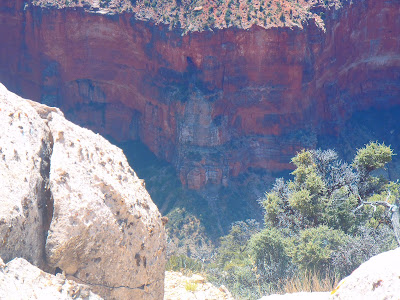
The whole idea of millions of years is beyond our thought process, but it is on display in front of our very eyes. Cheyava was definitely not flowing, but we could easily see the spot where it would flow from the cliffs. If it was me and I lived at the Grand Canyon, I would come out to Frances Matthes Point every April to see the water flow. It would be much easier than to hike down to Phantom Ranch, over to Clear Creek, and then up the Clear Creek drainage. Sure, looking up at a waterfall is much more interesting than looking down, but you still get to see it. Tim and I enjoyed this point and took many pictures. Then it was back on the old logging road, back to the car, and off to home again to hope that our house sells. I was hoping I would see Tim before I left for the Northwest, but who knows if I would. Still, he would be a life long friend as Tim has the same sense for adventure that I do.

Wednesday, May 27, 2020

Old BA


I don't know why I did not do this more often. I guess the pre-planning and committing to the long trip had kept me away. My friend Tim lived on the North Rim of the Grand Canyon. It is only like a 2 hour drive. I decided that I would go travel out to his neck of the woods to do a hike with him. Tim was always visiting and using our guest room when coming down to St. George for groceries. I guess it took a worldwide pandemic for me to get off the couch and join him. The drive was not too bad. Tim let me know how to get in to the gate since technically the park was closed. 


We met at the trailhead and were ready to go on the trail. This was a route that I had heard of but never done. The trail about 100 years ago used to stay in the Bright Angel Creek area instead of going up and away from it at Roaring Springs. We were going to descend down it. This was the right way to go as it was easier to route find when descending into the Grand Canyon rather than climbing out. We hung on the rim trail for a little bit and then the trail quickly descended. There were some signs of trail construction and at times a faint path, but for most of the early descent at least we had to keep our eyes peeled. Using my GPS watched helped considerably because it kept us on the path. Tim was the perfect person to do this trip with because he was in shape and up for anything. He is a law enforcement ranger on the North Rim, so this is something that he can make work even on a workday since he can easily check  out the trails and such on the hike out if need be. I think this was a day off for him, though, as there was no real need for us to be out there. The beginning was definitely the steepest section with lots of bushwhacking and amazing views of the canyon. 


Eventually it flattened out with us hugging the cliffside with views of a waterfall. There were times where we questioned whether we were on the right trail and times where we were definitely off of it for short periods, but all in all, the route was not all that difficult to find. It was not long before we were seeing Roaring Springs come into view and we were finding ourselves back on the North Kaibab Trail. Now just another 7 miles of uphill hiking to go. With no one else on the trail, it was a really enjoyable uphill hike. It had been a while since I was on the North Kaibab, so it felt exciting to relive some of my past adventures in this area. We hiked out and still had plenty of time to chill. I was staying at Tim's place and would sleep out on his patio. In the evening, we got to hang out with some other park people at the lodge. Since no other visitors were there, it was really nice to just sit on the lodge patio and chat it up. It had been a while since I worked for the NPS, so it was interesting hearing all the conversations from the park employees. Same old conversation with a new group. We had a chance to choose a new hike the following day, so we did not stay out too late and spent some of the evening hanging out at Tim's place with his girlfriend Kate. Definitely a fun day and looking forward to the next one.

Saturday, May 23, 2020

Just missed them


You win some, you lose some. On this one, we went out searching for some petroglyphs and we missed them. Instead we found a pleasant late spring hike in Red Cliffs/Snow Canyon. Parking near the off of SR-18, we were able to locate the route. It went along a bike path at first before we were able to hit the Gila Trail and then at some point we would leave the trail and head to some rolling slickrock mounds. The going was mostly pretty easy, though the day was hot and sunny. The route was easy enough for the kids to manage and for the wife to be okay with. There was definitely a route and we were not just finding our way as there were tracks to follow. 


Eventually it took us over slickrock to a bunch of slot canyons. The goal was to find the right one with the petroglyphs. We never did. Instead we found a bunch of really neat slot canyons and a nice place to have some lunch. I probably would have kept searching, but everyone seemed okay with it the way that it was and the hike was pretty regardless. So we headed on back. We had plenty to discuss with the house on the market and Zyla's 10th birthday coming up. The house had not sold after some initial interest. It was making us a little nervous, but it had only been a couple of weeks. We had been hard at work clearing out all the stuff that we did not need. We had sold many pieces of furniture on Facebook, Craigslist, and at consignment stores. We had given many boxes of things away to the thrift store also. The house was very comfortable at the point where it was time to leave soon. We were happy to spend much more time in Southern Utah enjoying the heat until that point. 

Sunday, May 17, 2020

Desert Tortoise


 School's out. It is only May 17th and we are nearing the end of our days in St. George area. Still, we had never seen an adult desert tortoise in the wild until today. Years ago, I had found one the size of a sand dollar, probably just born out in the Babylon area of Red Cliffs. It would be much more exciting to see an adult tortoise. My friend Matt Swartz told me that he saw a desert tortoise on the Chuckwalla Trail. I had never been, but it was a popular trailhead right outside of Snow Canyon. It was becoming summer in the Southwest as mid-May meant a hot sun, so an early start was necessary. We made it to the trailhead before the clock struck 10. 

The trail started near a climbing area and there were climbers out and about. We walked right on past them and into the early morning heat. The trail descended initially until it found its way to Halfway Wash. From here it split and there were a series of small loops that you could do. We were going to head up to Beck's Hill, but were quickly distracted by a large desert tortoise. Here it was right where he said he had seen one. We watched him for as long as he would let us and while he did not do much except eat some green vegetation and walk around, it was still a sight to behold. The kids were really excited, but probably not as excited as Jacqueline and I. 


When you live long enough, you realize that sometimes you have to accept the many hikes where nothing extraordinary is seen. On this one, we got to spend some time with the turtle, so the hike was already worthwhile. The rest of the hike was still nice. The trail took us past the red rocks and into some open country. The desert flowers were still abundant and the kids hiked well. We climbed up rather moderate slopes until we were able to make it to the junction with the Scout Cave trail. This was our spot to make a loop out of it and we continued back on the Turtle Wall trail hoping to see another tortoise along the way.


 Instead, we just saw red rocks and got a decent hike in before the sun turned on its full heat lamp. The turtles were absent as we passed by the same spot we had viewed them before, but we were pleased with the lucky find on the short jaunt on this beautiful spring day in Southern Utah. 

Thursday, May 14, 2020

Zion to Ourselves


How do you get Zion to yourself? Well, you go to a trail that is off the beaten path during a weekday. A lot had changed for us. School was let out early because of covid, so it was now summer break! We had already accepted jobs at McKenzie, so the whole staff knew that we were going to be gone soon. We had a farewell at the school to the students at school and for us it was a farewell to our teacher friends that we had met. Our house was already on the market. Jacqueline had spent a ridiculous amount of time cleaning it out.

 We had some boxes packed and we were starting to sell furniture and throw things out we were not going to need. Our time in Southern Utah was ticking away. So each hike could be our last. When the house was sold, we were out the door and heading back to the Northwest. Today we were off to one of my favorite trails, the Connector Trail. The Connector trail connects the Hop Valley Trail to the Wildcat Canyon Trail. It has a really boring name but it passes through many beautiful areas. You start by looking down into Hop Valley.


 Then the trail takes us across the feet of Spendlove Knoll to an amazing view down Lee Valley. It crosses the plains with flowers and views to the cliffs of Kolob in the north. Jacqueline took many, many pictures of anything she found charming and pretty. That means we got a lot of pictures. The kids were doing great. They were finally at this great age where we could take them anywhere at any distance and they seemed to be able to handle it. My favorite part of the whole trail was when we got to climb up the slickrock near Pine Valley Peak.


 Picking our way up the route using the cairns up the slickrock, it gave us a little off trail feel on an established trail. I convinced Jacqueline to let me drag her and the kids to an archeological site that I knew about near the Wildcat Canyon Trail. They were not too excited when they got there to realize that it was just a couple of logs from an old cabin used when they were logging the Wildcat Canyon area many years ago. This was our turnaround point, but I did convince them to go to a nice slickrock spot with a view to stop for lunch. We really were having a great day and the kids were so easy. Once we were out there, they loved to hike and just be out with us. I felt pretty lucky to have the family that I have. Heading back to the trailhead, we knew that we were going to have some interesting adventures in our future, but for today, we really had a good day having Zion to ourselves. We spent a huge chunk of the day out there and we really did not see anyone else. You really cannot beat that. 

Sunday, May 3, 2020

Back to Back Starvation Point Hikes


Jacqueline, the kids, and I love hiking to Starvation Point. It is just an ATV road right across the Arizona border in the Virgin River Gorge. We do it every year to see the wildflowers and the wildlife. This is where I saw my only in the wild Gila Monster and there are always numerous lizards. We even have a scoring system for wildlife. There are different point totals for different lizards. My favorite is the leopard lizard, but you can also see lots of horned lizards which is fun. The cactus flowers are in full bloom and it is perfect the last weekend in April. 


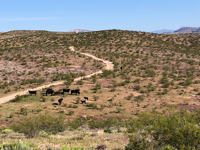
We had been looking forward to this. While the views are not spectacular most of the hike, we usually have it to ourselves with an occasional ATV driving by to ask if we are hurt or lost. They can never believe that someone would actually want to hike out there. We started off with a great hike. There were many lizards being spotted and Conrad even saw a young rattlesnake. The hike was going well until about 2 miles in, we saw some people off in the distance. When we made it to where they were, we talked to them for a little bit. It seemed that they were out there doing long distance shooting. This seemed like a great way to spoil a beautiful area. We kept hiking for a bit longer until the nervousness of having people out there shooting overtook Jacqueline. She decided that this was too much. We were going to have to turn around. I assured her that where they were shooting was far away from the direction that we were hiking, but she just couldn't take it. We had no choice but to turn around. I was frustrated because this had taken a great little Saturday hike and turned it into a short walk. We took our points and our tails and headed home with me expressing my displeasure for quite some time on the way back. 


This made us determined to return because we were not going to let some random people ruin our favorite hike. When we came back the next weekend, the random people were gone and the lizards were still there. The kids were troopers and we were able to get a full 10 miles in with many flowers and many lizards. We made it all the way out to the Virgin River Gorge view where we could see down to the Virgin River. My kids were amazing and we really had a fun day to make up for the lost hike from the shooting people. We had a lot to talk about on this hike because we had just accepted positions back at McKenzie. 


There was going to be less hiking and a little more packing to do as we had to sell our house, buy a new one, and get all of our stuff moved a 1000 miles away. We had just made the pandemic more interesting for ourselves by trying to do a big move in the middle of it. At first, we were just focused on getting our house shown and sold. So Jacqueline was cleaning up the place and making it look just right. The unfortunate thing about that is as soon as you do that, the place will be not yours anymore. For now though, it was just going to be a lot of work making this project happen. So it was nice to be out with the kids enjoying a beautiful spring day hiking there and back to Starvation Point.

Tuesday, April 21, 2020

Wandering Around Red Cliffs

 I had been getting rather adventurous with my afternoon hikes. The freedom to just go anywhere in Red Cliffs was too alluring and truly there was nothing else to do but check statistics on the covid infection rates and play games with the kids. We had started some afternoon basketball practice at our hoop that was now getting a lot more use. On days that I wasn't hiking, I was often running or going for walks around the neighborhood with Jacqueline. There were many books being read and we were also preparing for our interviews. We were strongly considering moving back to McKenzie. There were two open positions and they would soon interview us.  

We still didn't really know, but in a way we did know. If we had let things get this far, we were seriously considering it. We loved the desert and we were really happy with our house. Our jobs were good and we were paid well. We had great coworkers and our kids were happy, but it would only be this way for so long. In the end, our kids would end up at a different school from us and there were a lot of things that in our lives and at work were out of our control. The other thing it came down to was friends. We had met friends in Southern Utah, but not close friends that we had in Oregon. There were just many more positives for the future in Oregon.


 In Utah, we were kind of stuck in a life that did not quite fit us. It made us happy, but it was not quite what we were looking for. Still, things could go wrong somewhere else, whereas here in Utah, things were easy. Do you trade good and easy for something more risky? These were the questions I could think about while once again hiking up the hill and down it again, then under the freeway through the culvert, and off on whatever direction I felt like going. This time I found a canyon. It was not a very large canyon and it was not a well traveled canyon, but it was one that I had found to follow. Follow it, I did. It was on the border of a higher peak and it snaked its way around it. I decided to follow it for however far it would take me. It eventually led to a tall peak and seemed to emanate from its middle. It wasn't very long before I found another canyon and some more slick rock. The complete freedom of wandering without purpose or direction was something that I really enjoyed about the Red Cliffs area. There were so many different places to explore and unnamed features to find. This was really about exercise and discovery. I wouldn't repeat the hike again or recommend it to others, but when I found myself back at home, I knew I had a great day wandering around Red Cliffs.

Thursday, April 16, 2020

The Candy Cliffs of Yant Flat


The weather had been warm and dry for some time, so we decided to give the Danish Ranch Rd. a go. I wanted to wait until we didn't have the opportunity to get stuck out there because I had spent some time on that road in the last few months and I knew it could be in bad shape. We did our usual of waiting until school was out and then hitting the road. We headed north on I-70 and then took the exit as if we were going to Oak Grove. We drove up that road through Silver Reef for quite some time until instead of heading up toward the Pine Valley Mountains we went on the Danish Ranch Rd. 


Jacqueline was immediately not a fan. The road climbed quickly and had a pretty significant drop off to one side. It was also rather busy for some strange reason on a Thursday afternoon. After the initial shock to her system, though, she settled down after the road became a little more manageable. It was still rather crooked and we had to take it slow, but lucky for us, it looked like it had just been graded so was in really good shape. Our goal on this day was the Yant Flat Trailhead to access the Candy Cliffs. When we got to the trailhead there were quite a few cars there. 


This was surprising to me considering how far away we were from the main roads. We were able to find parking though and set out on what seemed like an old road that was the trailhead. Jacqueline could find the beauty in anything so she was just excited to see a blooming flower or a darkling beetle wandering across our path. As we slowly started to lose elevation, you could see the cliffs starting to appear below us. I could tell that this was going to be an awesome spot. The trail became more rocky and there were people scattered in various places along the rock. 


This hike was not really a destination hike, but more an immersive experience. When we carefully picked our way down to the slickrock formations, it was now up to us, to choose our path. We found a section with no one else around that turned out to be the most fantastic. We both took far too many pictures and wandered around all over. I went out to the edge to look down into Cottonwood Wash while Jacqueline and the kids had a snack, but other than that, the kids were able to do everything and go everywhere that we went. They could climb up little buttes and look out over the whole area. 


We spent at least an hour just exploring and everyone had a great time. Eventually, though, it became time to leave. We reluctantly went back up the trail and back to the car. We decided to drive all the way around the Danish Flat Rd. instead of going back the way that we came. This turned out to take a lot longer, but since the road was in good shape, there were no major obstacles. I was happy that the Xterra in its old age was still able to get us places that we wanted to go. It definitely turned out to be an enjoyable afternoon and we all agreed that this was one of our favorite hikes that we had done in the St. George area. 

Monday, April 13, 2020

Bone Wash


After a rousing Easter egg hunt at the house and a wonderful day spent together as a family, we still had another day off! What else would we do with our time when there was no major league baseball and no kids' activities to engage in then find a place to go for a hike. Today we choose Bone Wash. This was the route to Elephant Arch. Having been to the arch a couple of times, we decided to instead just continue up the wash to see what we could find. Having no school, we were able to get an earlier start than usual, though the air was already warm enough for most summer days not in the desert.


 The warmth was not going to be our friend because the wash was very sandy. It was slow going at first. We came to the junction for the turnoff to Elephant Arch marked by the narrow little slot canyon. We went the opposite direction but were soon foiled by a large pour off. Not being deterred, we picked our way around the pour off and found our way to a nice little canyon. We were able to follow it for quite some time before coming to a nice little pothole. Jacqueline was not the big risk taker, especially with the kids, so she said this was good. I thought we could get around, so Zyla and I made it around. We kept going for a little bit before running into another pothole. I am sure that the route could have continued further, but on this day we thought this was good enough. Besides there were flowers out and nice narrow slots to hike back through. We found a mini arch and just generally had a fun day. 


On the way out, we ran into one of my students and it was a little weird. Not that I would see a student outside of school, but just seeing someone else I recognized during the pandemic. We kept our distance while we exchanged cordial greetings. Near the trailhead we saw a large group and thought how irresponsible that was. Having someone like John Prine pass away with coronavirus, I felt like it was for real. How could such a large group hang out together during this strange time? We left them continue on their way and we headed home for another day keeping our family safe. 

Saturday, April 11, 2020

Cottonwood Canyon


Well, this weekend would usually be Easter Weekend and a four day break. We still had the four day break, but it wasn't quite as dramatic with online school. Plus, we couldn't do our usual where Jacqueline went up to Northern Utah to visit her brother and I stayed home and did a long trip into Zion. The backcountry of Zion was closed, so I settled for a goal I had for a long time. I was going to hike all of Cottonwood Canyon. This was the most common place for me to begin a run or a hike in Red Cliffs. Cottonwood Canyon was this very long dry creek bed running all the way through the northwest corner of Red Cliffs. 

I had hiked in it numerous times, but never all the way through. I had even had a very slow awkward run through it, but never again because Cottonwood Canyon was incredibly rocky. Very dry, but incredibly rocky. I got an early start. I figured there might be some people out there, but I got an early start before many other people were out there. This was lucky because with the recent wetter weather, the canyon was a little easier to walk with where the rocks melted away and the sand began. The sand gets rather firm after a rain. I was moving along quite well enjoying the crisp April morning weather. 


Many plants were starting to bloom including one I really liked with these vibrant purple flowers. The hiking was a slow slog up the drainage. There were not many obstacles, but when there were, they were easily negotiated. The really amazing part of the hike was looking up at the cliffs above. At first, it was not too exciting, but as I got further in, the slickrock domes rising above me looked amazing. The best was further up when I could see up to Yant Flat. This was a hike called the Candy Cliffs that I knew I had to go do sooner rather than later. 


I really enjoyed this area and I wondered if I was going to be able to make it out to the road. So far, no obstacles had gotten in my way. As I got closer to the road, I could actually see it above me and I wondered if  I was going to be able to make it up there. The hardest part of the whole hike was making it up the last mile. The canyon became overgrown and wet. There were lots of big boulders, but when I came out to the Danish Ranch Rd. after 8.5 miles of hiking I was stoked that I had made it all the way up the canyon. The elevation gain was around 1400 feet, but it is amazing how much quicker you could move downhill. The temperature was beginning to warm up and it was turning out to be a comfortable day in the mid 70s. The canyon was just as amazing on the way down with some sights more fantastic from a different angle. All and all, the entire 17 miles of hiking took me a little over 6 hours. 

The open canyon allowed for freedom of movement and I definitely achieved a goal. I wondered how many people had actually hiked all of Cottonwood Canyon. It had provided me with a new goal also. I had to get out to the Candy Cliffs because seeing them from below only brought more intrigue. What an amazing place Southern Utah is. 

Monday, April 6, 2020

Mustang Pass


 I will be honest about this one. When I looked at it on the map, it didn't seem that exciting. Actually putting boots on the ground, or hikng shoes more accurately, it turned out to be a rather nice hike. We started out immediately after work. It was like watching a countdown clock as we only had to work until noon. Then it was grab your backpacks, let get out the door. It left us to hike in the afternoon heat, but so far it had not been too hot in Southern Utah. On this day, we even had some overcast conditions. I had been running out in this area when I was training for the half marathon, so I thought this could be a good area to explore. We started by driving up the Mill Creek Rd. This was another dirt road which turned out to be in fairly good shape. The trailhead had a few cars, but since this was the trailhead for Elephant Arch, we figured that there wasn't much to worry about the trail being too busy. It was still a concern for us since we did not know a lot about coronavirus except that people seemed to be dying quite frequently. 


The Mill Creek trail headed out from here which we followed. It was just an old dirt road and you could tell. We followed that until the junction with the Mustang Pass Trail. As soon as we turned off, we felt like we were actually on a trail. With the overcast conditions, it was very pleasant. We immediately encountered a big bull snake. This looks just like a rattle snake without the venomous bite. We left it alone and let it have its space. With the kids, we sometimes play a game where different animal sighting are worth different point values. The first one to see them gets the points. This was definitely a 15-pointer as the snake was massive. 


The sweeping views were awesome and everyone was having a great time. Jacqueline was excited about all the flowers that were out and the kids were interested in the various large cacti around. The trail continued to climb toward the volcanic buttes and we were headed right in between them. It had the feel of hiking to a mountain lake without the big trees and such. Still there was the anticipation of questioning what we would see on the other side of the pass. What we saw was a big open valley. 


It seemed like a great place to have a reservoir and it sounded like that was the original goal of the settlers in the early days. All of these trails and roads in Red Cliffs had some sort of history with the development of St. George. Once we topped out on the pass, it was downhill back to the car through a boulder field with many volcanic boulders. The whole hike was only 5-6  miles but it was very pleasant on a perfect day to be outside. Now it was back to the house for our forced confinement. 

Sunday, April 5, 2020

Cinder Cone


 Near Snow Canyon and right along the road there is a cinder cone that is obvious. I wondered if there was a trail up it and it turned out that there was. I decided that this must be hiked. I researched to see if my family could do it and it seemed like they could, so we set out to accomplish the task. On this day, we even used a weekend rather than a day after school to do the hike. Since it was Sunday in Utah, though, in the morning especially, we had the whole thing to ourselves. 


Sort of an advantage there to not be a member of the same church as a majority of the population, but there were other disadvantages also, though I am sure at this point most of their meetings were happening in an online setting. Getting to the trailhead was easy, though we drove right by it the first time because we weren't quite sure where to park. The parking ended up being right next to the road and the trailhead left from there. There were two choices of trails. One was very steep that charged right up to the top of the crater. The one that we were going to take was much more gradual. It skirted around the backside of the cinder cone.

At first it was not too steep, but then it began to charge up the talus. We went through a few cattle grates and then eventually were charging up the hill. This hike was pretty short as we could see the whole hike from where we started, but it turned out to be awesome. The kids did great and when we topped out at the high point on top of the Cinder Cone, we had sweeping views of the whole area. Especially awesome was the view of Snow Canyon. We could also see into Diamond Valley and over into Red Cliffs. We took a bunch of pictures, then the kids and the wife hung out while I scurried down into the crater. 


The route went around the crater before charging straight down. There wasn't much to see except for a bunch of stacked rocks. This was definitely an extinct volcano. I made it back to the wife and kids, then it was time to go down. We held hands on the way down due to the suggestion of the wife, but the kids handled it with ease. They were great hikers even if they did complain about having to go on hikes, they always did great when they were out there. It was an easy downhill walk back to the car with the whole hike taking only about an hour. Then it was back to home to our forced quarantine to ponder our future. Southern Utah was amazing, but we were really leaning toward a return to Oregon. We would have to get rehired at our old jobs, but it was looking more and more likely. 

Friday, April 3, 2020

Santa Clara Petroglyphs


Friday and it doesn't even really matter that much that it is. Another week of school online complete. It was our second full week complete and it didn't look like things were changing any time soon. So, it was another day with no baseball season to watch, an NCAA tournament cancelled, but a lot of free time to explore the area around us. So off we went to find some petroglyphs. We had been branching out to hikes that we had never done before and there were many choices. Today, it was off to Tempi'po'op to view some petroglyphs. 


We used our Google Maps and got us to the trailhead. It was a tight parking lot with a lot of cars. I was a bit worried about leaving the car with a few of the characters around the trailhead, but in the end it ended up okay. We headed up the trail. The first part was unremarkable. Just open desert with views of the area. As we approached the top of the ridge, though, you could see the desert varnish and you knew it was going to be good. There were so many petroglyphs! Bighorn sheep, spirals, men, footprints, etc... This was an amazing site and it seemed like once again we had a lot of it to ourselves.


 This was a great spot overlooking the Santa Clara River. You could see why this spot was here. Farm down below, look for game and invaders up above. What do you do while you are up there? Carve intricate designs into the rock. And they were everywhere and all we had to do was wander around to find them. Nooks and crannies, on wide open exposed rock, everywhere. Jacqueline, Conrad, Zyla and I all had time to admire them and enjoy the works of art left behind. We took a lot of pictures before we continued the hike. 


It went out to a ridge and we went around the loop. The loop was nothing too exciting as the petroglyphs made the day. The hike itself was only a little over 3 miles, but worth our time to see some amazing sites. Everyone seemed to enjoy themselves and it was definitely something worth seeing with the whole family.