Tuesday, April 21, 2020

Wandering Around Red Cliffs

 I had been getting rather adventurous with my afternoon hikes. The freedom to just go anywhere in Red Cliffs was too alluring and truly there was nothing else to do but check statistics on the covid infection rates and play games with the kids. We had started some afternoon basketball practice at our hoop that was now getting a lot more use. On days that I wasn't hiking, I was often running or going for walks around the neighborhood with Jacqueline. There were many books being read and we were also preparing for our interviews. We were strongly considering moving back to McKenzie. There were two open positions and they would soon interview us.  

We still didn't really know, but in a way we did know. If we had let things get this far, we were seriously considering it. We loved the desert and we were really happy with our house. Our jobs were good and we were paid well. We had great coworkers and our kids were happy, but it would only be this way for so long. In the end, our kids would end up at a different school from us and there were a lot of things that in our lives and at work were out of our control. The other thing it came down to was friends. We had met friends in Southern Utah, but not close friends that we had in Oregon. There were just many more positives for the future in Oregon.


 In Utah, we were kind of stuck in a life that did not quite fit us. It made us happy, but it was not quite what we were looking for. Still, things could go wrong somewhere else, whereas here in Utah, things were easy. Do you trade good and easy for something more risky? These were the questions I could think about while once again hiking up the hill and down it again, then under the freeway through the culvert, and off on whatever direction I felt like going. This time I found a canyon. It was not a very large canyon and it was not a well traveled canyon, but it was one that I had found to follow. Follow it, I did. It was on the border of a higher peak and it snaked its way around it. I decided to follow it for however far it would take me. It eventually led to a tall peak and seemed to emanate from its middle. It wasn't very long before I found another canyon and some more slick rock. The complete freedom of wandering without purpose or direction was something that I really enjoyed about the Red Cliffs area. There were so many different places to explore and unnamed features to find. This was really about exercise and discovery. I wouldn't repeat the hike again or recommend it to others, but when I found myself back at home, I knew I had a great day wandering around Red Cliffs.

Thursday, April 16, 2020

The Candy Cliffs of Yant Flat


The weather had been warm and dry for some time, so we decided to give the Danish Ranch Rd. a go. I wanted to wait until we didn't have the opportunity to get stuck out there because I had spent some time on that road in the last few months and I knew it could be in bad shape. We did our usual of waiting until school was out and then hitting the road. We headed north on I-70 and then took the exit as if we were going to Oak Grove. We drove up that road through Silver Reef for quite some time until instead of heading up toward the Pine Valley Mountains we went on the Danish Ranch Rd. 


Jacqueline was immediately not a fan. The road climbed quickly and had a pretty significant drop off to one side. It was also rather busy for some strange reason on a Thursday afternoon. After the initial shock to her system, though, she settled down after the road became a little more manageable. It was still rather crooked and we had to take it slow, but lucky for us, it looked like it had just been graded so was in really good shape. Our goal on this day was the Yant Flat Trailhead to access the Candy Cliffs. When we got to the trailhead there were quite a few cars there. 


This was surprising to me considering how far away we were from the main roads. We were able to find parking though and set out on what seemed like an old road that was the trailhead. Jacqueline could find the beauty in anything so she was just excited to see a blooming flower or a darkling beetle wandering across our path. As we slowly started to lose elevation, you could see the cliffs starting to appear below us. I could tell that this was going to be an awesome spot. The trail became more rocky and there were people scattered in various places along the rock. 


This hike was not really a destination hike, but more an immersive experience. When we carefully picked our way down to the slickrock formations, it was now up to us, to choose our path. We found a section with no one else around that turned out to be the most fantastic. We both took far too many pictures and wandered around all over. I went out to the edge to look down into Cottonwood Wash while Jacqueline and the kids had a snack, but other than that, the kids were able to do everything and go everywhere that we went. They could climb up little buttes and look out over the whole area. 


We spent at least an hour just exploring and everyone had a great time. Eventually, though, it became time to leave. We reluctantly went back up the trail and back to the car. We decided to drive all the way around the Danish Flat Rd. instead of going back the way that we came. This turned out to take a lot longer, but since the road was in good shape, there were no major obstacles. I was happy that the Xterra in its old age was still able to get us places that we wanted to go. It definitely turned out to be an enjoyable afternoon and we all agreed that this was one of our favorite hikes that we had done in the St. George area. 

Monday, April 13, 2020

Bone Wash


After a rousing Easter egg hunt at the house and a wonderful day spent together as a family, we still had another day off! What else would we do with our time when there was no major league baseball and no kids' activities to engage in then find a place to go for a hike. Today we choose Bone Wash. This was the route to Elephant Arch. Having been to the arch a couple of times, we decided to instead just continue up the wash to see what we could find. Having no school, we were able to get an earlier start than usual, though the air was already warm enough for most summer days not in the desert.


 The warmth was not going to be our friend because the wash was very sandy. It was slow going at first. We came to the junction for the turnoff to Elephant Arch marked by the narrow little slot canyon. We went the opposite direction but were soon foiled by a large pour off. Not being deterred, we picked our way around the pour off and found our way to a nice little canyon. We were able to follow it for quite some time before coming to a nice little pothole. Jacqueline was not the big risk taker, especially with the kids, so she said this was good. I thought we could get around, so Zyla and I made it around. We kept going for a little bit before running into another pothole. I am sure that the route could have continued further, but on this day we thought this was good enough. Besides there were flowers out and nice narrow slots to hike back through. We found a mini arch and just generally had a fun day. 


On the way out, we ran into one of my students and it was a little weird. Not that I would see a student outside of school, but just seeing someone else I recognized during the pandemic. We kept our distance while we exchanged cordial greetings. Near the trailhead we saw a large group and thought how irresponsible that was. Having someone like John Prine pass away with coronavirus, I felt like it was for real. How could such a large group hang out together during this strange time? We left them continue on their way and we headed home for another day keeping our family safe. 

Saturday, April 11, 2020

Cottonwood Canyon


Well, this weekend would usually be Easter Weekend and a four day break. We still had the four day break, but it wasn't quite as dramatic with online school. Plus, we couldn't do our usual where Jacqueline went up to Northern Utah to visit her brother and I stayed home and did a long trip into Zion. The backcountry of Zion was closed, so I settled for a goal I had for a long time. I was going to hike all of Cottonwood Canyon. This was the most common place for me to begin a run or a hike in Red Cliffs. Cottonwood Canyon was this very long dry creek bed running all the way through the northwest corner of Red Cliffs. 

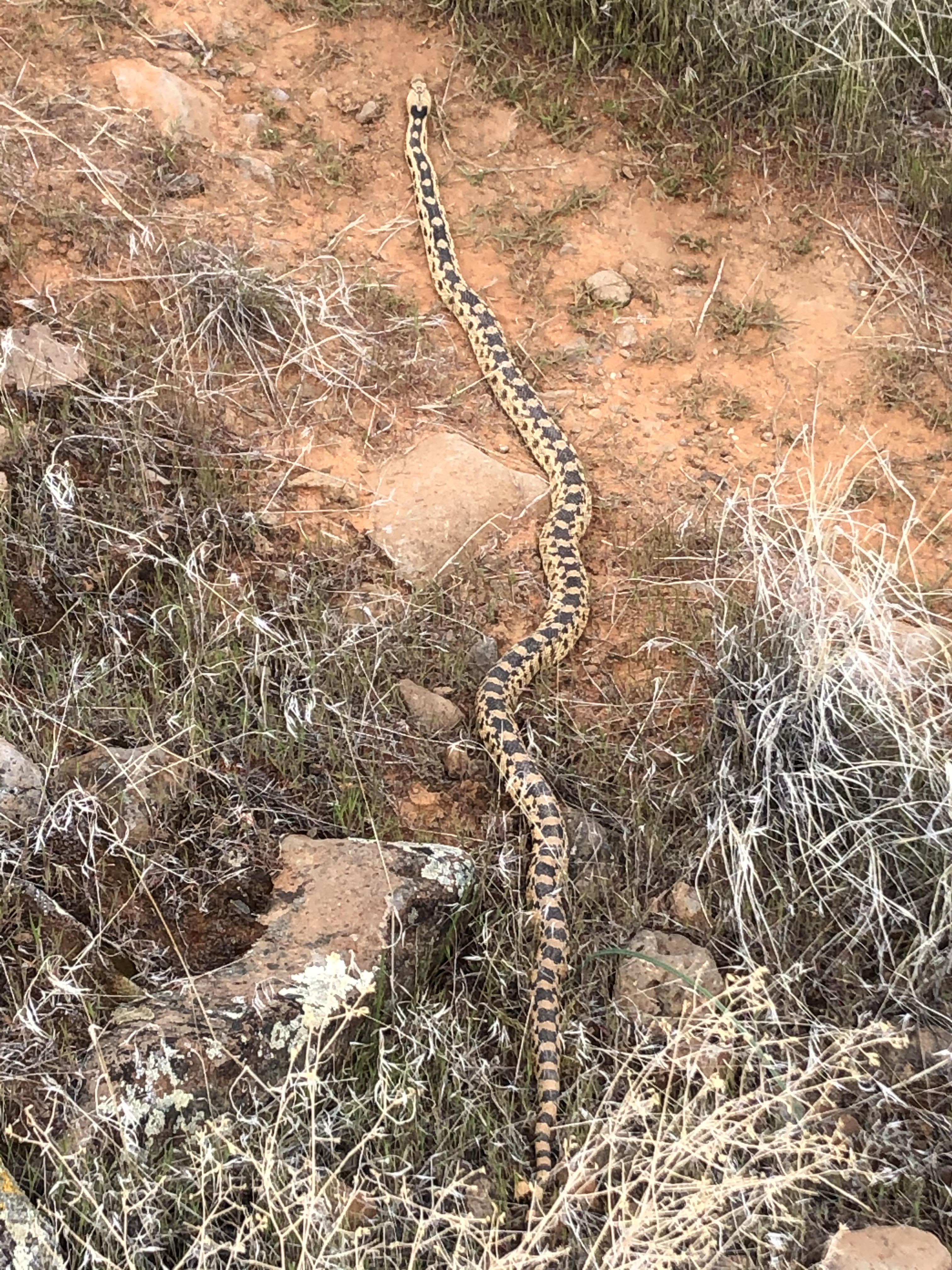
I had hiked in it numerous times, but never all the way through. I had even had a very slow awkward run through it, but never again because Cottonwood Canyon was incredibly rocky. Very dry, but incredibly rocky. I got an early start. I figured there might be some people out there, but I got an early start before many other people were out there. This was lucky because with the recent wetter weather, the canyon was a little easier to walk with where the rocks melted away and the sand began. The sand gets rather firm after a rain. I was moving along quite well enjoying the crisp April morning weather. 


Many plants were starting to bloom including one I really liked with these vibrant purple flowers. The hiking was a slow slog up the drainage. There were not many obstacles, but when there were, they were easily negotiated. The really amazing part of the hike was looking up at the cliffs above. At first, it was not too exciting, but as I got further in, the slickrock domes rising above me looked amazing. The best was further up when I could see up to Yant Flat. This was a hike called the Candy Cliffs that I knew I had to go do sooner rather than later. 


I really enjoyed this area and I wondered if I was going to be able to make it out to the road. So far, no obstacles had gotten in my way. As I got closer to the road, I could actually see it above me and I wondered if  I was going to be able to make it up there. The hardest part of the whole hike was making it up the last mile. The canyon became overgrown and wet. There were lots of big boulders, but when I came out to the Danish Ranch Rd. after 8.5 miles of hiking I was stoked that I had made it all the way up the canyon. The elevation gain was around 1400 feet, but it is amazing how much quicker you could move downhill. The temperature was beginning to warm up and it was turning out to be a comfortable day in the mid 70s. The canyon was just as amazing on the way down with some sights more fantastic from a different angle. All and all, the entire 17 miles of hiking took me a little over 6 hours. 

The open canyon allowed for freedom of movement and I definitely achieved a goal. I wondered how many people had actually hiked all of Cottonwood Canyon. It had provided me with a new goal also. I had to get out to the Candy Cliffs because seeing them from below only brought more intrigue. What an amazing place Southern Utah is. 

Monday, April 6, 2020

Mustang Pass


 I will be honest about this one. When I looked at it on the map, it didn't seem that exciting. Actually putting boots on the ground, or hikng shoes more accurately, it turned out to be a rather nice hike. We started out immediately after work. It was like watching a countdown clock as we only had to work until noon. Then it was grab your backpacks, let get out the door. It left us to hike in the afternoon heat, but so far it had not been too hot in Southern Utah. On this day, we even had some overcast conditions. I had been running out in this area when I was training for the half marathon, so I thought this could be a good area to explore. We started by driving up the Mill Creek Rd. This was another dirt road which turned out to be in fairly good shape. The trailhead had a few cars, but since this was the trailhead for Elephant Arch, we figured that there wasn't much to worry about the trail being too busy. It was still a concern for us since we did not know a lot about coronavirus except that people seemed to be dying quite frequently. 


The Mill Creek trail headed out from here which we followed. It was just an old dirt road and you could tell. We followed that until the junction with the Mustang Pass Trail. As soon as we turned off, we felt like we were actually on a trail. With the overcast conditions, it was very pleasant. We immediately encountered a big bull snake. This looks just like a rattle snake without the venomous bite. We left it alone and let it have its space. With the kids, we sometimes play a game where different animal sighting are worth different point values. The first one to see them gets the points. This was definitely a 15-pointer as the snake was massive. 


The sweeping views were awesome and everyone was having a great time. Jacqueline was excited about all the flowers that were out and the kids were interested in the various large cacti around. The trail continued to climb toward the volcanic buttes and we were headed right in between them. It had the feel of hiking to a mountain lake without the big trees and such. Still there was the anticipation of questioning what we would see on the other side of the pass. What we saw was a big open valley. 


It seemed like a great place to have a reservoir and it sounded like that was the original goal of the settlers in the early days. All of these trails and roads in Red Cliffs had some sort of history with the development of St. George. Once we topped out on the pass, it was downhill back to the car through a boulder field with many volcanic boulders. The whole hike was only 5-6  miles but it was very pleasant on a perfect day to be outside. Now it was back to the house for our forced confinement. 

Sunday, April 5, 2020

Cinder Cone


 Near Snow Canyon and right along the road there is a cinder cone that is obvious. I wondered if there was a trail up it and it turned out that there was. I decided that this must be hiked. I researched to see if my family could do it and it seemed like they could, so we set out to accomplish the task. On this day, we even used a weekend rather than a day after school to do the hike. Since it was Sunday in Utah, though, in the morning especially, we had the whole thing to ourselves. 


Sort of an advantage there to not be a member of the same church as a majority of the population, but there were other disadvantages also, though I am sure at this point most of their meetings were happening in an online setting. Getting to the trailhead was easy, though we drove right by it the first time because we weren't quite sure where to park. The parking ended up being right next to the road and the trailhead left from there. There were two choices of trails. One was very steep that charged right up to the top of the crater. The one that we were going to take was much more gradual. It skirted around the backside of the cinder cone.

At first it was not too steep, but then it began to charge up the talus. We went through a few cattle grates and then eventually were charging up the hill. This hike was pretty short as we could see the whole hike from where we started, but it turned out to be awesome. The kids did great and when we topped out at the high point on top of the Cinder Cone, we had sweeping views of the whole area. Especially awesome was the view of Snow Canyon. We could also see into Diamond Valley and over into Red Cliffs. We took a bunch of pictures, then the kids and the wife hung out while I scurried down into the crater. 


The route went around the crater before charging straight down. There wasn't much to see except for a bunch of stacked rocks. This was definitely an extinct volcano. I made it back to the wife and kids, then it was time to go down. We held hands on the way down due to the suggestion of the wife, but the kids handled it with ease. They were great hikers even if they did complain about having to go on hikes, they always did great when they were out there. It was an easy downhill walk back to the car with the whole hike taking only about an hour. Then it was back to home to our forced quarantine to ponder our future. Southern Utah was amazing, but we were really leaning toward a return to Oregon. We would have to get rehired at our old jobs, but it was looking more and more likely. 

Friday, April 3, 2020

Santa Clara Petroglyphs


Friday and it doesn't even really matter that much that it is. Another week of school online complete. It was our second full week complete and it didn't look like things were changing any time soon. So, it was another day with no baseball season to watch, an NCAA tournament cancelled, but a lot of free time to explore the area around us. So off we went to find some petroglyphs. We had been branching out to hikes that we had never done before and there were many choices. Today, it was off to Tempi'po'op to view some petroglyphs. 


We used our Google Maps and got us to the trailhead. It was a tight parking lot with a lot of cars. I was a bit worried about leaving the car with a few of the characters around the trailhead, but in the end it ended up okay. We headed up the trail. The first part was unremarkable. Just open desert with views of the area. As we approached the top of the ridge, though, you could see the desert varnish and you knew it was going to be good. There were so many petroglyphs! Bighorn sheep, spirals, men, footprints, etc... This was an amazing site and it seemed like once again we had a lot of it to ourselves.


 This was a great spot overlooking the Santa Clara River. You could see why this spot was here. Farm down below, look for game and invaders up above. What do you do while you are up there? Carve intricate designs into the rock. And they were everywhere and all we had to do was wander around to find them. Nooks and crannies, on wide open exposed rock, everywhere. Jacqueline, Conrad, Zyla and I all had time to admire them and enjoy the works of art left behind. We took a lot of pictures before we continued the hike. 


It went out to a ridge and we went around the loop. The loop was nothing too exciting as the petroglyphs made the day. The hike itself was only a little over 3 miles, but worth our time to see some amazing sites. Everyone seemed to enjoy themselves and it was definitely something worth seeing with the whole family.

Thursday, April 2, 2020

Big Hollow


Continuing the new tradition of hiking after work, I was ready to go at noon. It was like the magic time when I transitioned from online learning teacher and parent supervisor of online learning for my own children to having the entire rest of the day to myself. We were keeping ourselves safe and the best way to do that was to go hike in the wide open spaces of Southern Utah. This day was a day I had to myself to hike. I had always wanted to make my way up Cottonwood Canyon. There were two options in Cottonwood Canyon and on this day, I was planning to go through Big Hollow. 


I had heard that it was nice and slotty up above, but the main motivation was just to put in some miles. The beginning part of Cottonwood Canyon I had done numerous times. It is a dry wash with many big boulders in it. I had tried running it even and it was not a very easy run. Today, I was just hiking but my goal was to move as fast as I could up it. The great part about having a watch with a GPS and a map that always told me where I was, was that I didn't have to take any time to pull out a map. So I kept a good steady pace through the beginning part until I came to the junction.


 I could go to the left and head up the main branch of Cottonwood Canyon or I can turn right and head up Big Hollow. Big Hollow it was and right away I was rewarded with a narrower canyon with slickrock peaks rising right above me. It was still a wash and for quite a bit of time it was dry. As I got closer to the end, though, there were definitely some potholes of water to get around while also having to climb through some rocky areas with a few pour-offs to get around. This was definitely a nice canyon and as I was getting closer to the top, I heard first then saw the only other people on this hike. Yankee Doodle Canyon comes in to Big Hollow and when I got to it, I made sure to walk up it a bit to just check it out. Eventually the narrowness and even the canyon and slickrock feel went away and as I got closer to the top, it became much more forested. 


There was even some old structures there built obviously long ago for some unknown reason now. The goal was to make it all the way to the road and in the upper stretches, this goal was apparent because the scenery wasn't more than walking through a pinon-juniper forest. Near the end the route paralleled the road until finally popping out onto the gravel surface. It had been nearly 7 miles of hiking to get to this point, so that meant that I got to go back 7 miles. The 1200 feet of elevation gain was deceiving though, because when you are in a wash, you just go steadily uphill without really noticing it. 


Going back down the wash, though, it really feels like you are going downhill because you are moving much quicker without getting as tired. Also, going down the obstacles is usually much easier than going up. There is something just so great about just putting in the miles and feeling good. After about 5 hours of hiking I was back at the car and feeling pretty good about a trip up Big Hollow.