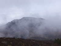
 I drove down a dirt road until the road looked too muddy and then just started walking. I was feeling pretty good on this day as I was just hauling. I studied my route on Google Earth the day before so I knew that I had to be patient. Southern Utah does not have much for well made trails, but they seem to have quite a few well made roads that no one drives on. This was one of those as I knew that it would go most of the way to the top considering there was a cell tower up there.
 So I stayed patient as lots of roads split off, until finally I hit the one I thought that I wanted. It switched back a bit, but soon I was entering the mist. I could not tell how far I went, how long it was to go, or what could be around the next bend. I just kept following my road. Soon there was snow, which made it a bit more interesting. Then I saw the towers faintly through the fog and I knew I was close.
 From here I knew that the route to the summit was not too far away. (For a good pic of the summit, check my October blog for the highest point in the background.) Unfortunately, the road kept going except it was going straight up. The angle was rather steep and someone with an ATV decided that they were going to get to the top the easy way. That road went all the way to the summit ridge. All I had to do was traverse over a ways until I was at the true summit to chill out. The view was incredible.
 Actually it should have been, but there was nothing but mist. Toquerville peak is one of those peaks where if you were to climb its West Face, it would be highly technical. I should have been able to look down and see much of Southern Utah. Instead, all I saw was the fog.
 I snapped a couple pics and headed down, losing the trail/road in the fog for a while before finally
 rediscovering it. When I got off the steep climb to the summit, the fog lifted for thirty seconds and I got a semi-decent view of the land below through the cell towers.
 Then I just wandered on back to my truck with nothing interesting happening except for the sighting of three deer. All and all, the trip took me a total of 3 hr 45 min round trip. It was a good hike, one that I would do again to maybe catch the views from the summit.
No comments:
Post a Comment