It had been a long winter of taking care of children. And while I love my children very much, it sure takes away from opportunities to get out away from the roads. I took advantage of Dad being around to use it as an opportunity to actually take a trip. We decided to spend some time in Escalante-Vermillion Cliffs area. We thought once again about getting in on the Wave, but when we arrived in Kanab, the office was closed. We already had an alternative thought out, so we proceeded in that direction. Our goal for the day was to hike out to Cobra Arch.

Quite an impressive name, so we hoped the arch could live up to it. Getting there required a drive on a sandy dirt road. We got to the trailhead at about 10 AM, so that gave us plenty of time to complete this hike as it was only about 6 miles round trip. We headed off on the route to what we thought was the arch. We found it interesting that the Middle Route into Buckskin Gulch was the same route as the trip out to Cobra Arch. We found out the hard way that we were wrong. We had route descriptions for both and I made the mistake of reading the wrong route description. After a little while, we realized our mistake, but since we had plenty of time, we continued to check out the Middle Route.

It lead right to Buckskin Gulch. We did a bit of downclimbing through some tricky terrain. It still put us about fifty feet above the canyon. We could see the route in which was kind of an exposed downclimb. We decided to not try it since we were not planning to travel through Buckskin Gulch anyway and we did not think that we would be able to make it up. So we had to head back most of the way that we had come. Then we headed a different direction entirely to make it out to Cobra Arch. We did some rim walking for the first mile or so.

Then we found our way down a slickrock slope to where we were walking on some slickrock, some sand. I had my GPS which helped us to find the arch. I could see something in the distance and thought it was the arch, but when we got to it, it turned out to just be an interesting rock that was not an arch. We walked around the slickrock wilderness and it was very beautiful.
We saw no one else out in this area, but it was fantastic. We wandered around for quite some time completely missing the arch even though we had a map. We had to backtrack until we were able to track it down. It was quite unusual with the shape of a cobra with striations along its top to make it look like the segments of a cobra's back. I don't think there could be any other name for this arch other than Cobra Arch. We hung out for a bit and ate some food. Then it was time to turn around and head back. We found a bit of a quicker way to get back by staying on the rim and cutting across the sandy woods to the car.

Then it was down the dirt road again to head over toward the Paria Movie Set. We were planning to camp near this spot to hike the very next day. There was no camping at the Movie Set, so we went up the road a small ways and each set up a tent. We had some dinner and hung out before retiring for the evening. It turned out to be an incredibly cold night. I used my new sleeping bag that was only rated to 40 degrees.

It did not keep me warm enough and in the middle of the night, I had to throw on my dirty underwear over my long underwear and short to give my butt a bit more warmth. I tossed and turned for most of the night getting some sleep. Dad kind of said he had the same experience. We were up and moving early, though the temperatures were in the teens so it wasn't entirely enjoyable to be up that early. We had ourselves some breakfast which it was hard to get enough heat out of the stove with those temps, but eventually we were ready to go. Our goal for the day was to get up to Starlight Arch.
This was going to be more challenging than the hike out to Cobra Arch. We first started down a wash that took off from the Paria Movie Set. This was an old dirt road that we couldn't have driven. Eventually the road was washed out and we took a right turn up a random wash.
We had to make sure to follow the route description pretty close on this one as we didn't want to hit the wrong wash. So far, so good. Eventually the wash led us to a more open area with some steep, crumbly forested cliffs. It was now time to go uphill.
For some reason, Dad and I chose different paths at this point. He was much further to the right then me and I just went up the steep slope. I managed to make it up onto the plateau with just some effort and not an incredible amount of difficult scrambling. Once I was there, I wandered around trying for some time to find Dad. I saw him still making his way up the cliff after wandering around the whole plateau. He seemed like he would not have any problem getting up from where he was, so I took his picture and then wandered on over to where Starlight Arch was. We could see it a bit from below, but it just looked like a small window. I decided to visit the other side that we could not see from below.

This turned out to be the right choice. Eventually Dad found his way over and he climbed up to meet me on top of a rock where we had some lunch and snapped some photos. We also had a good view of Mollie's Nipple and Castle Rock. We wandered over to the front side of Starlight Arch, which was not as good of a view, but the one that was put in the guide book. Not an inspiring picture for a decent arch. Then we picked our way down the cliff side and returned by our same route to the car. We were back to the car by 3 and were off to home in Springdale. The kids were happy to see Popo as he stayed with us for the evening. This was definitely the most adventurous trip I took during the winter, but still a bit tame as far as trips go. I still enjoyed it and felt both of these hikes well worth the effort.

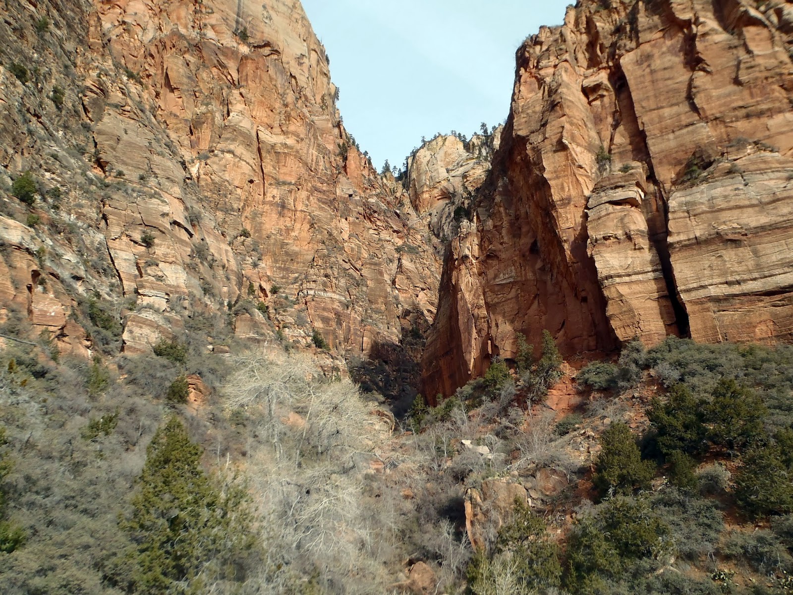
 Knowing that it looked rather interesting up there, but never having attempted to find out what was there, I was glad that I took the time on this day for a little exploring. It was pretty, but for the first part, it was much like any other open wash in Zion. Then it narrowed down and some obstacles presented themselves. I found some ways around them, some requiring a little bit of maneuvering within the wash up some rocks, some requiring some brush fighting through the trees. I was surprised to see water flowing in this usually dry canyon. There were even some icicles remaining in the cool February sun. Through my scrambling, I eventually made it to the top of the canyon where there was a pour-off that would have been an incredible waterfall had there been more water. Every time that one goes up these remarkable canyons, one hopes to find some formation that is unique. This one did not quite have it, but if it did, I was prepared to rename it the Scogway. I am not sure it would have caught on. Instead, I tried to get up above the waterfall by climbing up the side of the cliff. It was going fine until a few minutes in when I thought that this seemed rather pointless and unnecessarily difficult for something that probably isn't that interesting and I was on work time, so the relevance of this trip was slowly waning away. So I turned around and came back out the way I came. Not a gem, but everything is worth doing once.