Sunday, May 31, 2020

Yellow Knolls


Well our time in Southern Utah was coming to an abrupt end, though our house was still on the market. It was frustrating us a little bit considering how quickly things were selling. We decided to make the best of it, though, and just enjoy our time off. We were now able to hang out with friends again because the pandemic was getting tiring. It wasn't like it was over, it was just not really hitting Southern Utah very hard. Conrad was back playing soccer and the kids were doing tennis again. We invited our friends Amanda and Eric to do a hike. We decided to head out to the Yellow Knolls because the features were so cool and they had never been there before.

 It was a nice spot and we talked with them while we walked. The kids were with us and they were able to hang out while we conversed with our friends. We were lucky because the weather was unseasonably cool with some overcast conditions. It would still get up into the 80s during the day, but for now we had some cool weather especially since we got an early start which was rare with Jacqueline. The trail started downhill through open sandy meadows. Then went up a jumbled path through volcanic rocks. It then came out to the most unique looking formations of fractured sandstone. It was almost scale like looking like the scales of some giant dinosaur. The kids and I made sure to get our money's worth, climbing all over the scales of these hexagonal fractures. I think it is one of the more unique features in an area full of unique features. After playing around long enough, we headed up the trail more. We only made it to the junction and everyone seemed to think it was far enough. On the way back, we saw a leopard lizard which always made me happy. The leopard lizard is by far my favorite. Other than that, nothing too remarkable occurred. Very happy to spend some time with Amanda and Eric. They are very nice people and we would be leaving behind many nice people when leaving. But we were off to new adventures, as soon as the house sells.

Thursday, May 28, 2020

Francois Matthes Point


Tim and I had a morning to hike something at the Grand Canyon. There were many trail options but having a down and up day the day before, meaning we went down into the canyon and came back up, we decided to hang out on the rim. I had always wanted to get my eyes on Cheyava Falls which is the tallest waterfall in the Grand Canyon. It is a bit elusive and only runs during the Spring. It was Spring now, but likely it would not still be flowing because you need a good bit of snow melt and we hadn't had that lately. I still wanted to give it a shot. 


We figured out that if we hiked out to Frances Matthes Point, we could peer down into Cheyava Falls. Frances Matthes was a photographer in the early days of photography and would popularize the Grand Canyon with some of his photographs. We figured if this point was named after him, it was probably pretty photogenic. We also found out that if we parked on an old abandoned logging road, there would be a path most of the way to the point for us to follow. So that is what we did. The walking was really pretty easy being mostly flat rim trail walking. We ran into a couple of interesting things including a survey marker and an old ladder.
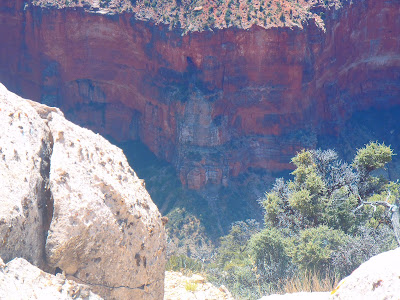
 Mostly it was walking through open forest with not much to fight off in the way of vegetation on the forest carpet. When getting to the point, we had to sort of pick our best route to the edge, but when we did, we were rewarded almost immediately with amazing views of the canyon. This was an angle I had not seen it from before, so it was amazing. There is no good way to sum up the feeling that you get when you look off into the distance in the Grand Canyon. It is the feeling of eternity that this place had been here for millions of years looking very similar to how it looks now, but also the knowledge that it took millions of years for it to become what it is. 

The whole idea of millions of years is beyond our thought process, but it is on display in front of our very eyes. Cheyava was definitely not flowing, but we could easily see the spot where it would flow from the cliffs. If it was me and I lived at the Grand Canyon, I would come out to Frances Matthes Point every April to see the water flow. It would be much easier than to hike down to Phantom Ranch, over to Clear Creek, and then up the Clear Creek drainage. Sure, looking up at a waterfall is much more interesting than looking down, but you still get to see it. Tim and I enjoyed this point and took many pictures. Then it was back on the old logging road, back to the car, and off to home again to hope that our house sells. I was hoping I would see Tim before I left for the Northwest, but who knows if I would. Still, he would be a life long friend as Tim has the same sense for adventure that I do.

Wednesday, May 27, 2020

Old BA


I don't know why I did not do this more often. I guess the pre-planning and committing to the long trip had kept me away. My friend Tim lived on the North Rim of the Grand Canyon. It is only like a 2 hour drive. I decided that I would go travel out to his neck of the woods to do a hike with him. Tim was always visiting and using our guest room when coming down to St. George for groceries. I guess it took a worldwide pandemic for me to get off the couch and join him. The drive was not too bad. Tim let me know how to get in to the gate since technically the park was closed. 


We met at the trailhead and were ready to go on the trail. This was a route that I had heard of but never done. The trail about 100 years ago used to stay in the Bright Angel Creek area instead of going up and away from it at Roaring Springs. We were going to descend down it. This was the right way to go as it was easier to route find when descending into the Grand Canyon rather than climbing out. We hung on the rim trail for a little bit and then the trail quickly descended. There were some signs of trail construction and at times a faint path, but for most of the early descent at least we had to keep our eyes peeled. Using my GPS watched helped considerably because it kept us on the path. Tim was the perfect person to do this trip with because he was in shape and up for anything. He is a law enforcement ranger on the North Rim, so this is something that he can make work even on a workday since he can easily check  out the trails and such on the hike out if need be. I think this was a day off for him, though, as there was no real need for us to be out there. The beginning was definitely the steepest section with lots of bushwhacking and amazing views of the canyon. 


Eventually it flattened out with us hugging the cliffside with views of a waterfall. There were times where we questioned whether we were on the right trail and times where we were definitely off of it for short periods, but all in all, the route was not all that difficult to find. It was not long before we were seeing Roaring Springs come into view and we were finding ourselves back on the North Kaibab Trail. Now just another 7 miles of uphill hiking to go. With no one else on the trail, it was a really enjoyable uphill hike. It had been a while since I was on the North Kaibab, so it felt exciting to relive some of my past adventures in this area. We hiked out and still had plenty of time to chill. I was staying at Tim's place and would sleep out on his patio. In the evening, we got to hang out with some other park people at the lodge. Since no other visitors were there, it was really nice to just sit on the lodge patio and chat it up. It had been a while since I worked for the NPS, so it was interesting hearing all the conversations from the park employees. Same old conversation with a new group. We had a chance to choose a new hike the following day, so we did not stay out too late and spent some of the evening hanging out at Tim's place with his girlfriend Kate. Definitely a fun day and looking forward to the next one.